
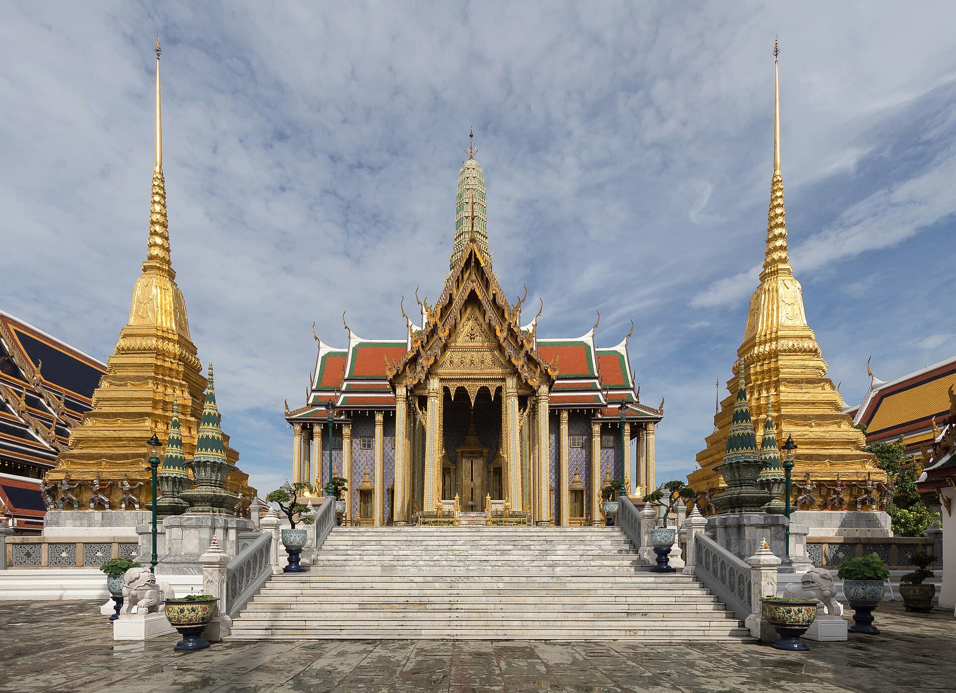
Ornamented buildings of Wat Phra Kaew inside the palace walls.
Photo Basile Morin · CC BY-SA 4.0
Photo on Wikimedia Commons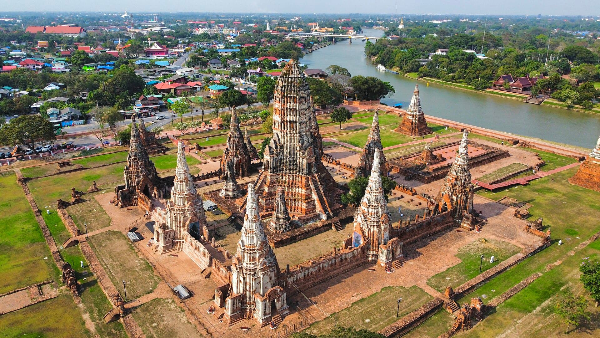
Wat Chaiwatthanaram from the air on the west bank of the Chao Phraya.
Photo Average trinmo · CC BY-SA 4.0
Photo on Wikimedia Commons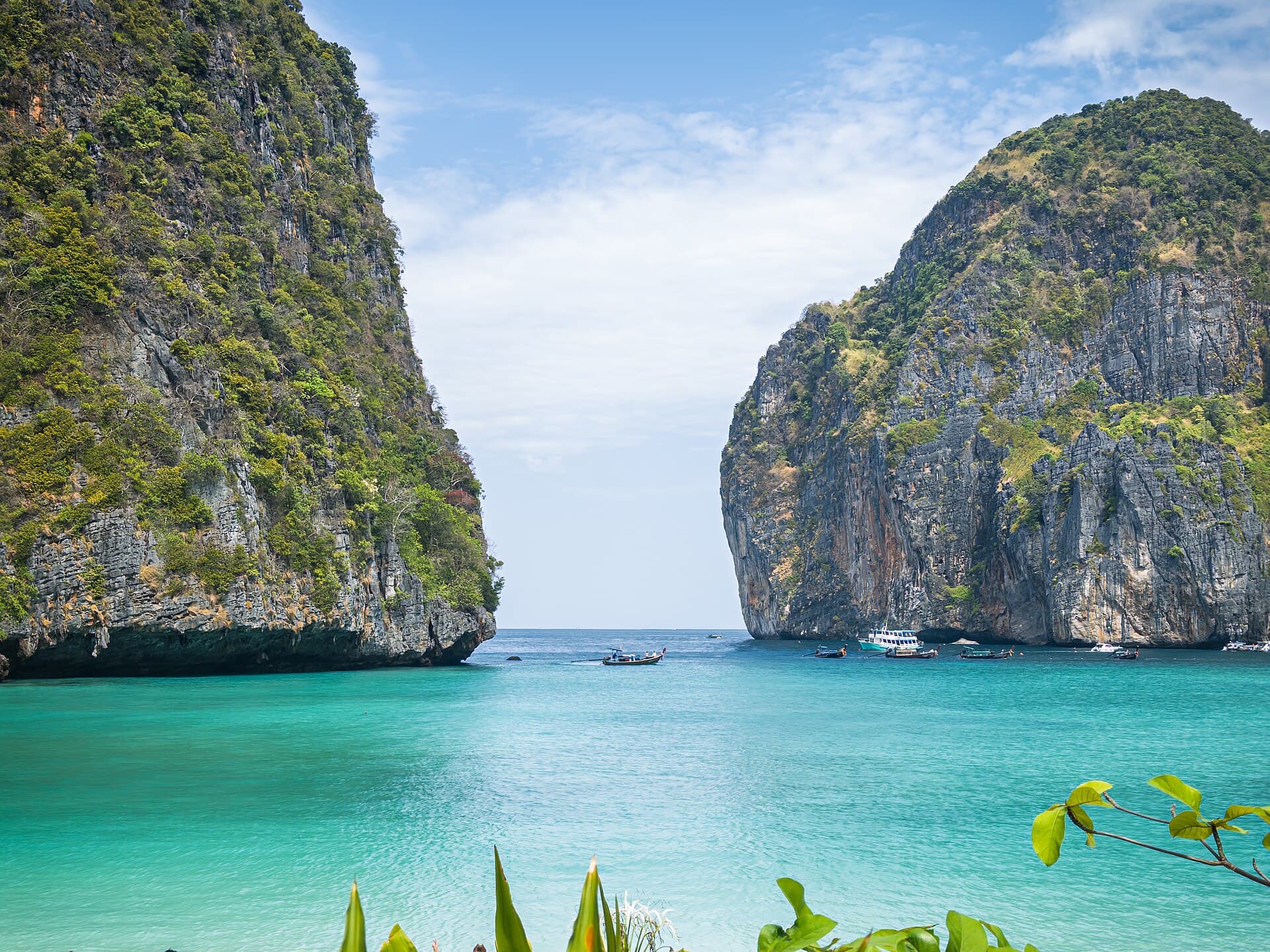
Maya Bay enclosed by cliffs on Ko Phi Phi Le.
Photo Nnthurber · CC BY-SA 4.0
Photo on Wikimedia Commons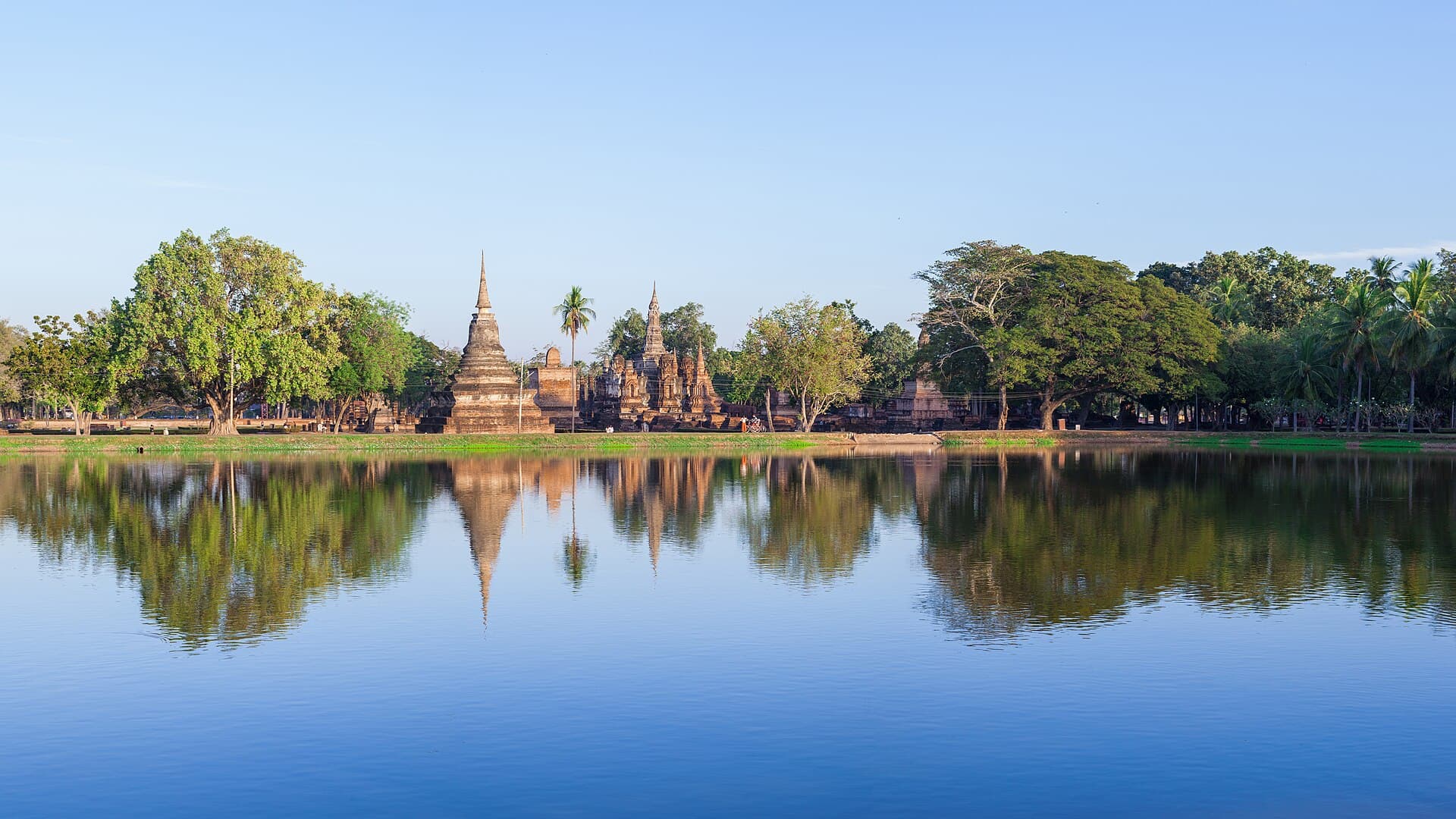
The stupa of Wat Mahathat in Sukhothai Historical Park.
Photo Supanut Arunoprayote · CC BY 4.0
Photo on Wikimedia Commons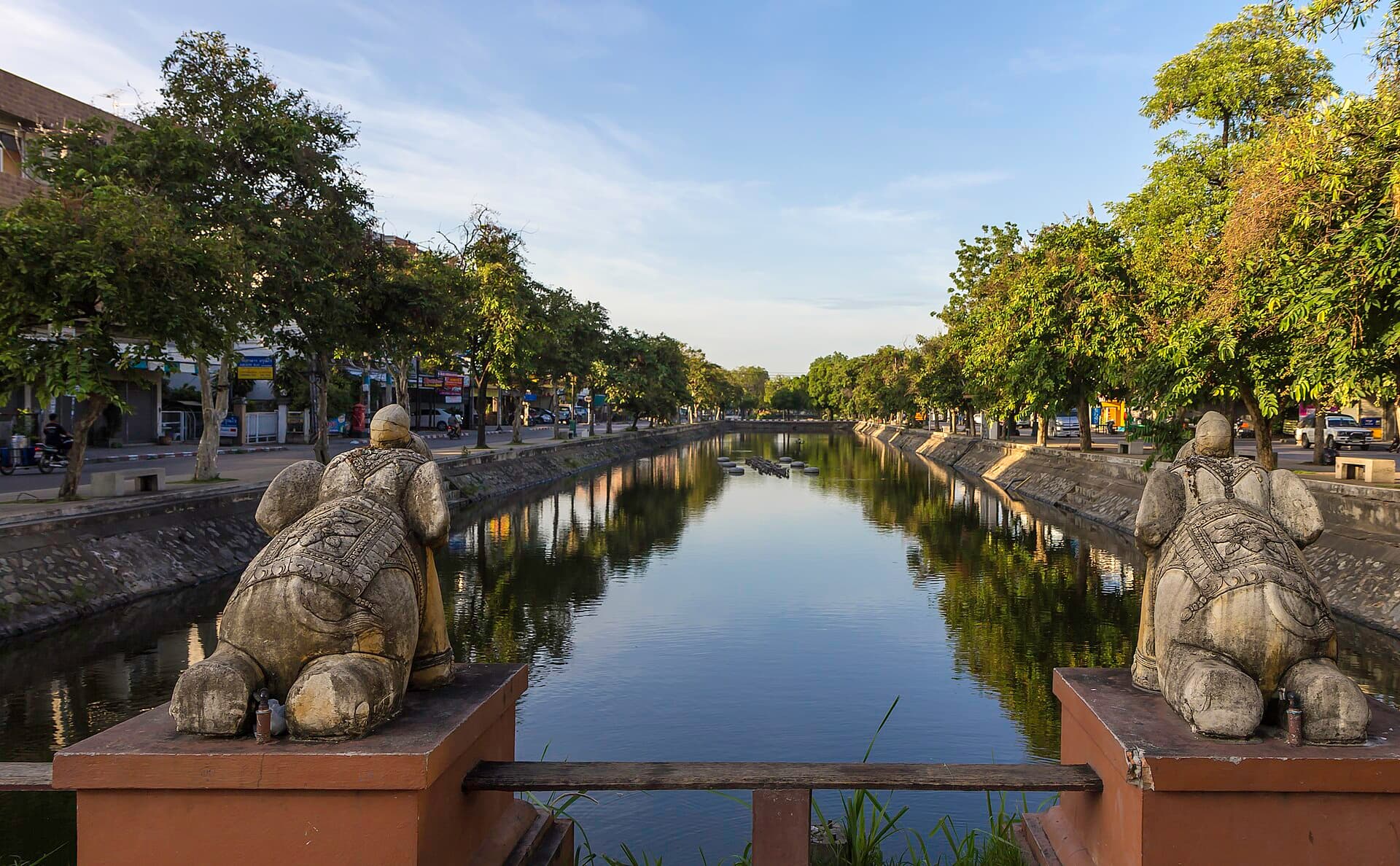
A corner of the Chiang Mai moat and the brick wall on the bank.
Photo Stefan Fussan · CC BY-SA 3.0
Photo on Wikimedia Commons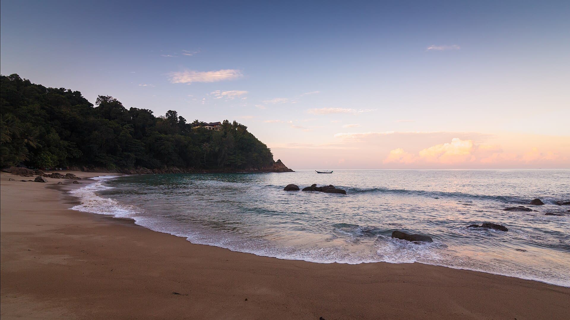
A sandy cove with turquoise water and rock on the Phuket coast.
Photo Anton Zelenov · CC BY-SA 4.0
Photo on Wikimedia Commons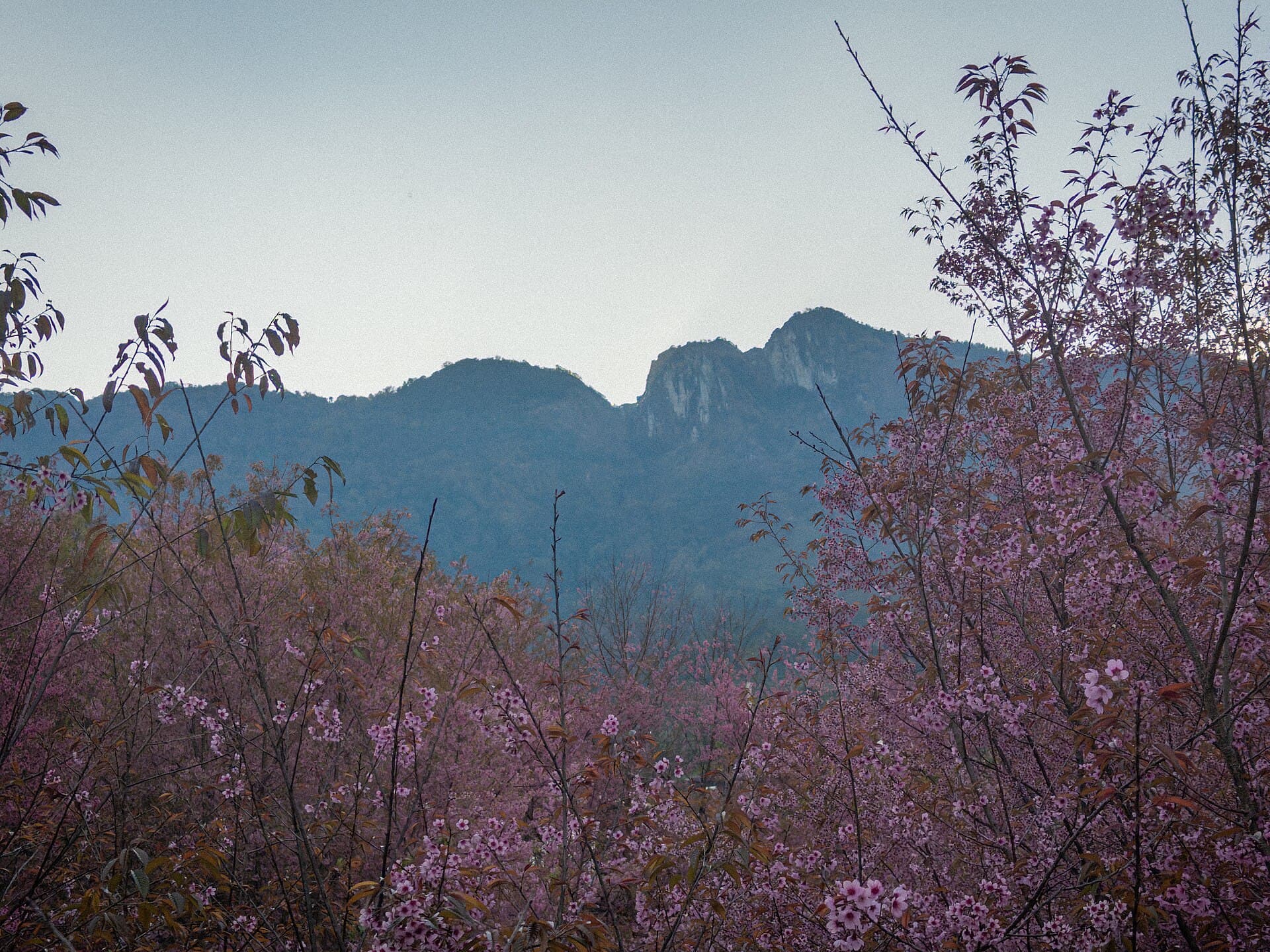
White blossom and the mountain silhouette on a slope of Doi Inthanon.
Photo Nnthurber · CC BY-SA 4.0
Photo on Wikimedia Commons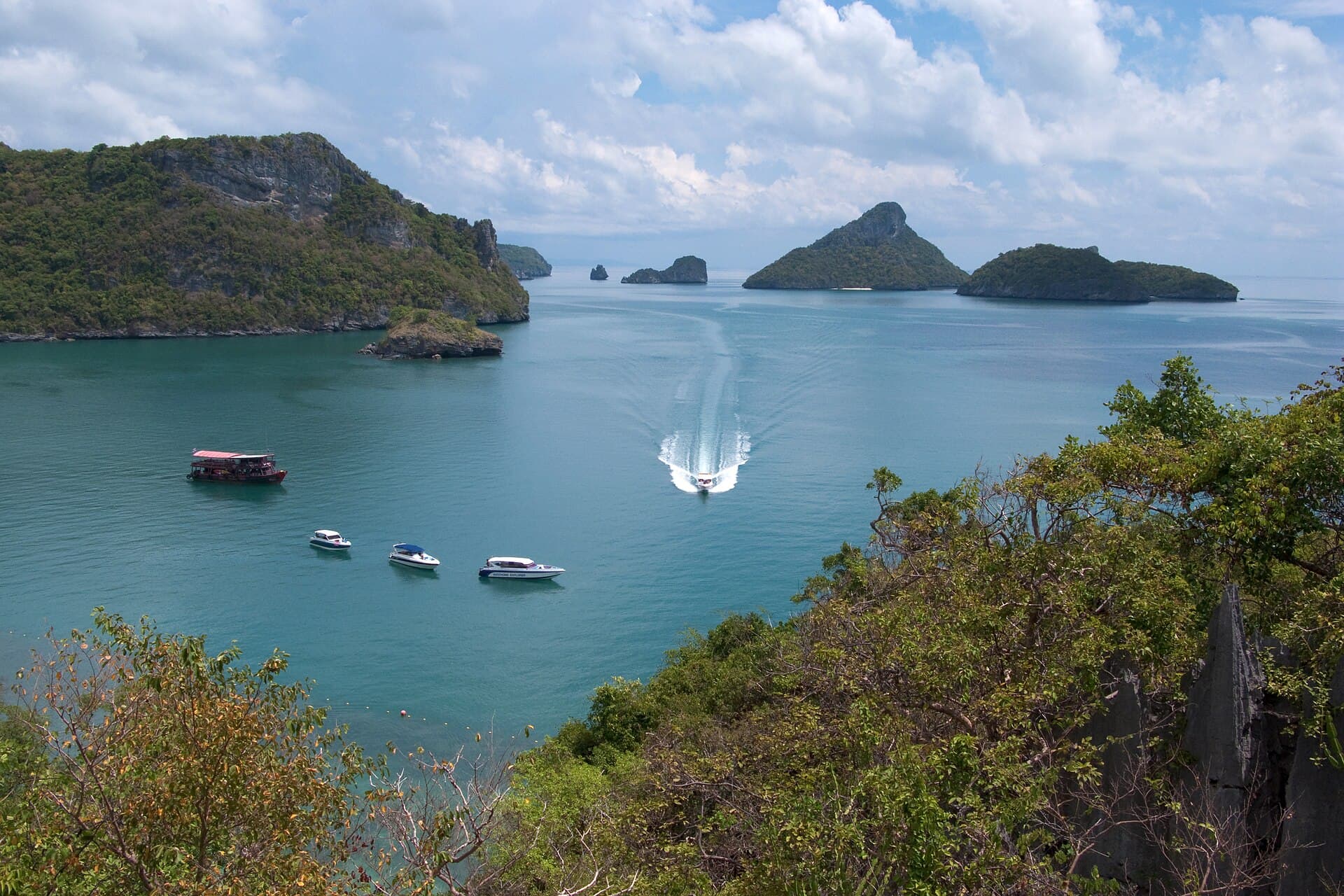
A sheltered bay among the Ang Thong islands in the Gulf of Thailand.
Photo Vyacheslav Argenberg · CC BY 4.0
Photo on Wikimedia CommonsSoutheast Asia, between the Gulf of Thailand and the Andaman Sea
Thailand
River cities, brick ruins, northern mountains, and islands on two coasts.
Thailand sits in Southeast Asia between the Gulf of Thailand and the Andaman Sea, with Myanmar, Laos, Cambodia and Malaysia along its land borders. It covers 513,120 square kilometres. Civil registration in 2024 counted 65,975,198 people. The capital is Bangkok. Thai is the official language, the baht is issued by the Bank of Thailand, and clocks stay seven hours ahead of Greenwich all year. The highest point is Doi Inthanon at 2,565 metres in the north. The coastline runs for 2,815 kilometres.
Bangkok is a low city on the Chao Phraya, a river 372 kilometres long. It became the capital on 21 April 1782. The Grand Palace complex was begun on 6 May 1782 and covers 218,400 square metres inside four walls. Wat Phra Kaew, inside those walls, was begun in 1783 and holds a small green stone figure. South of the palace, Wat Pho has a reclining figure 46 metres long. On the west bank in Thonburi, the main prang of Wat Arun was built in 1851.
North of the capital, Ayutthaya stands on an island where the Chao Phraya meets the Pa Sak. It was founded in 1351. The municipality covers 14.84 square kilometres, and the historical park was listed in 1991. Farther north, Sukhothai Historical Park holds 193 ruins across 70 square kilometres. The walls form a rectangle about 2 kilometres east to west and 1.6 kilometres north to south, with twenty-six temples inside and Wat Mahathat the largest. That park was listed in 1991 as well, within the Historic Town of Sukhothai and Associated Historic Towns. As of 2026 the country has nine World Heritage sites: six cultural and three natural. The latest is Wat Phra Mahathat Woramahawihan in Nakhon Si Thammarat.
Chiang Mai lies about 700 kilometres north of Bangkok. It was founded in 1296 as the new capital of Lan Na, and the name means new city. The municipality covers 40.216 square kilometres and had 127,240 residents in the 2019 figure, while the built-up area exceeds a million. The old city is roughly a square about a mile on each side, with a brick wall and a moat. Doi Suthep rises to 1,676 metres about 15 kilometres from the centre, and the twin summit of Doi Pui reaches 1,685 metres. The usual way up Doi Inthanon is the road through a national park created in 1954 and covering 482.4 square kilometres.
In the south, Phuket is the country’s largest island, plus 32 smaller ones in the Andaman Sea. The province covers 547 square kilometres and had 432,464 people in 2025. The Sarasin Bridge links it to the Phang Nga mainland. Krabi lies east across the same bay: a province of 5,323 square kilometres, with the Railay peninsula reachable only by boat because of the limestone cliffs, and the Phi Phi Islands at 12.06 square kilometres. In the gulf, Ko Samui covers 228.7 square kilometres, the second largest island after Phuket. Offshore, Mu Ko Ang Thong holds 42 islands across 102 square kilometres and was established on 12 November 1980.
Rain does not follow one calendar. In Bangkok, September is the wettest month at 335.9 millimetres in the 1991–2020 normals, while November on Ko Samui reaches 444.6 millimetres. The Andaman coast is drier from November through February. Five airports shape the trip: Suvarnabhumi is the busiest, then Don Mueang, Phuket, Chiang Mai and Krabi. The general price level is about 31 percent of the United States level on 2025 figures, and it measures the whole economy, not hotels alone. Entry rules depend on nationality; the official electronic-visa page is the place to check before you travel.
Key cities and regions
Bangkok
The capital on the Chao Phraya: the Grand Palace, Wat Phra Kaew, Wat Pho, and the prang of Wat Arun on the west bank.
Ayutthaya
A former capital on a river island, a historical park listed in 1991, and Wat Chaiwatthanaram on the west bank.
Chiang Mai
The walled northern city, about 700 kilometres from Bangkok, and the gate to Doi Suthep.
Sukhothai
A park of 13th- and 14th-century ruins: Wat Mahathat, Wat Sa Si in its lake, and Wat Si Chum.
Phuket
The largest Andaman island, with smaller islands offshore and the Sarasin Bridge toward Phang Nga.
Krabi
Limestone cliffs, the boat-only Railay peninsula, and the Phi Phi Islands with Maya Bay.
Ko Samui
The gulf’s second-largest island, wettest in November, with the Ang Thong archipelago offshore.
Want to know Thailand better?
A journey in photos, maps, and figures—one step at a time.
What does a flight to Thailand cost—and when is it cheaper?
Check from your city →Flights to Thailand
FAQ about Thailand
When is the best time to visit Thailand?
November to February is the comfortable stretch in Bangkok and the north: the December mean low in the capital is 23.2°C, and Chiang Mai’s January mean low is 15.7°C. Phuket is drier then than in September, which records 361.2 millimetres. That calendar does not fit the gulf. On Ko Samui, November is the wettest month at 444.6 millimetres. March and April are hot, and May to October brings most of the rain across much of the country.
How many days do you need?
Chiang Mai is about 700 kilometres from Bangkok, and the southern coasts are another journey. Ten days to two weeks covers the capital, nearby Ayutthaya, either the north or Sukhothai, and one coast: Phuket and Krabi on the Andaman, or Ko Samui in the gulf. A week is enough for Bangkok and Ayutthaya if time is short, and leaves the islands for another trip.
Is Thailand expensive?
The general price level is about 31 percent of the United States level on 2025 figures. The figure divides the purchasing-power conversion factor by the official exchange rate, so it describes the whole economy, not a hotel bill or a street meal. Prices on the ground still differ between the capital and the islands. The index does not replace the rate at the place you are booking.
What currency is used in Thailand?
The currency is the Thai baht. One baht is 100 satang, and the Bank of Thailand issues it. Prices on signs and in markets are in this unit. Keep small notes for stalls and boats, and change money at a bank or a counter with a clear rate before you head out to the islands.
How do you get around?
Five airports cover most domestic hops: Suvarnabhumi and Don Mueang in the capital, then Phuket, Chiang Mai and Krabi. The Northern Line links Bangkok with Chiang Mai. It is 751 kilometres long, opened on 26 March 1896, was completed on 1 January 1922, and uses a 1,000-millimetre gauge. Long-distance trains leave Krung Thep Aphiwat. Railay and the islands are reached by boat because of the cliffs.
Do you need a visa?
Entry conditions depend on nationality, length of stay and purpose, and they do not fit in one sentence. Before you buy a ticket, read the official electronic-visa page run by the Ministry of Foreign Affairs. It carries the current requirements and the application. Rules change, and that page is the reference, not a forum summary.
Andaman or the gulf?
Phuket and Krabi face the Andaman Sea, where rain is lighter from the end of the year into the next, and September is among the wettest months. Ko Samui and Ang Thong sit in the Gulf of Thailand. Samui’s heaviest rain falls in October, November and December: 294.9, then 444.6, then 263.1 millimetres. For a calmer sea in November, head to the Andaman coast rather than the gulf.
Photos (30)
Sources & photo credits(46 sources · 36 photos · last verified 2026-10-11)
- 1.Thailand · Wikipedia · Accessed 2026-10-11
- 2.Geography of Thailand · Wikipedia · Accessed 2026-10-11
- 3.Bangkok · Wikipedia · Accessed 2026-10-11
- 4.Phra Nakhon Si Ayutthaya (city) · Wikipedia · Accessed 2026-10-11
- 5.Ayutthaya Historical Park · Wikipedia · Accessed 2026-10-11
- 6.Chiang Mai · Wikipedia · Accessed 2026-10-11
- 7.Sukhothai Historical Park · Wikipedia · Accessed 2026-10-11
- 8.Phuket province · Wikipedia · Accessed 2026-10-11
- 9.Krabi province · Wikipedia · Accessed 2026-10-11
- 10.Ko Samui · Wikipedia · Accessed 2026-10-11
- 11.Doi Inthanon · Wikipedia · Accessed 2026-10-11
- 12.Doi Suthep · Wikipedia · Accessed 2026-10-11
- 13.Wat Phra That Doi Suthep · Wikipedia · Accessed 2026-10-11
- 14.Railay Beach · Wikipedia · Accessed 2026-10-11
- 15.Grand Palace · Wikipedia · Accessed 2026-10-11
- 16.Wat Arun · Wikipedia · Accessed 2026-10-11
- 17.Wat Pho · Wikipedia · Accessed 2026-10-11
- 18.Wat Phra Kaew · Wikipedia · Accessed 2026-10-11
- 19.Wat Chaiwatthanaram · Wikipedia · Accessed 2026-10-11
- 20.List of World Heritage Sites in Thailand · Wikipedia · Accessed 2026-10-11
- 21.Thai baht · Wikipedia · Accessed 2026-10-11
- 22.Suvarnabhumi Airport · Wikipedia · Accessed 2026-10-11
- 23.Don Mueang International Airport · Wikipedia · Accessed 2026-10-11
- 24.Chiang Mai International Airport · Wikipedia · Accessed 2026-10-11
- 25.Phuket International Airport · Wikipedia · Accessed 2026-10-11
- 26.Krabi International Airport · Wikipedia · Accessed 2026-10-11
- 27.Samui Airport · Wikipedia · Accessed 2026-10-11
- 28.Chao Phraya River · Wikipedia · Accessed 2026-10-11
- 29.Northern Line (Thailand) · Wikipedia · Accessed 2026-10-11
- 30.Chatuchak Weekend Market · Wikipedia · Accessed 2026-10-11
- 31.Jim Thompson House · Wikipedia · Accessed 2026-10-11
- 32.Damnoen Saduak Floating Market · Wikipedia · Accessed 2026-10-11
- 33.Pad thai · Wikipedia · Accessed 2026-10-11
- 34.Tom yum · Wikipedia · Accessed 2026-10-11
- 35.Massaman curry · Wikipedia · Accessed 2026-10-11
- 36.Khao soi · Wikipedia · Accessed 2026-10-11
- 37.Green curry · Wikipedia · Accessed 2026-10-11
- 38.Mango sticky rice · Wikipedia · Accessed 2026-10-11
- 39.Mu Ko Ang Thong National Park · Wikipedia · Accessed 2026-10-11
- 40.Phang Nga Bay · Wikipedia · Accessed 2026-10-11
- 41.Khao Phing Kan · Wikipedia · Accessed 2026-10-11
- 42.Phi Phi Islands · Wikipedia · Accessed 2026-10-11
- 43.Ko Phi Phi Le · Wikipedia · Accessed 2026-10-11
- 44.PPP conversion factor, GDP (LCU per international $) · World Bank · Accessed 2026-10-11
- 45.Official exchange rate (LCU per US$, period average) · World Bank · Accessed 2026-10-11
- 46.Official Website of Thailand Electronic Visa · Ministry of Foreign Affairs · Accessed 2026-10-11
- The porcelain-covered prang of Wat Arun on the west bank of the Chao Phraya in Bangkok. · Diego Delso · CC BY-SA 3.0
- A gilded roof in the Grand Palace complex at first light. · Bjørn Erik Pedersen · CC BY-SA 4.0
- Ornamented buildings of Wat Phra Kaew inside the palace walls. · Basile Morin · CC BY-SA 4.0
- Colonnades in the Wat Pho complex just south of the Grand Palace. · Diego Delso · CC BY-SA 3.0
- The long reclining figure inside a hall at Wat Pho. · Diego Delso · CC BY-SA 3.0
- The Chao Phraya flowing between its banks in Bangkok. · Supanut Arunoprayote · CC BY 4.0
- Traditional wooden houses in the Jim Thompson compound beside the khlong. · Deror_avi · CC BY-SA 3.0
- Brick ruins in Ayutthaya Historical Park under an open sky. · Gary Todd from Xinzheng, China · CC0
- Wat Chaiwatthanaram from the air on the west bank of the Chao Phraya. · Average trinmo · CC BY-SA 4.0
- A row of brick prangs at Wat Mahathat in Ayutthaya. · Diego Delso · CC BY-SA 3.0
- The stupa of Wat Mahathat in Sukhothai Historical Park. · Supanut Arunoprayote · CC BY 4.0
- The lotus-bud shape of the Wat Mahathat stupa at Sukhothai. · Wiriya Somboonphol · CC BY-SA 4.0
- Wat Sa Si seen across the lotus pond at Sukhothai. · Dominic Nelson · CC BY-SA 4.0
- The square mandapa front of Wat Si Chum. · Philip Nalangan · CC BY 4.0
- Wat Mahathat and the park around it at Sukhothai. · Zupernice · CC BY-SA 4.0
- The moat in front of the old city wall in Chiang Mai. · Stefan Fussan · CC BY-SA 3.0
- The moat and old wall in Chiang Mai after dark. · Douglas Perkins · CC BY 4.0
- A corner of the Chiang Mai moat and the brick wall on the bank. · Stefan Fussan · CC BY-SA 3.0
- A road at dusk inside Doi Inthanon National Park. · Khunkay · CC BY-SA 3.0
- White blossom and the mountain silhouette on a slope of Doi Inthanon. · Nnthurber · CC BY-SA 4.0
- The green ridges of Doi Pui near Chiang Mai. · Vyacheslav Argenberg · CC BY 4.0
- A sandy cove with turquoise water and rock on the Phuket coast. · Anton Zelenov · CC BY-SA 4.0
- Pale sand and clear water along the Phuket shore. · Anton Zelenov · CC BY-SA 4.0
- Limestone cliffs rising above Railay beach. · Shivashanky · CC BY-SA 4.0
- Rai Leh bay between walls of limestone. · Christophe95 · CC BY-SA 4.0
- Maya Bay enclosed by cliffs on Ko Phi Phi Le. · Nnthurber · CC BY-SA 4.0
- A limestone stack standing in Phang Nga Bay. · Vyacheslav Argenberg · CC BY 4.0
- The slopes of Ko Phi Phi Le above the sea. · Diego Delso · CC BY-SA 3.0
- Islands of Ang Thong National Park from the Pha Jun Jaras viewpoint. · Christophe95 · CC BY-SA 4.0
- A sheltered bay among the Ang Thong islands in the Gulf of Thailand. · Vyacheslav Argenberg · CC BY 4.0
- A small island in the sea of Mu Ko Ang Thong. · Vyacheslav Argenberg · CC BY 4.0
- A quiet stretch of the Ko Samui shore, seen from Ko Pha Ngan. · Christophe95 · CC BY-SA 4.0
- A bowl of khao soi with wheat noodles in Chiang Mai. · Takeaway · CC BY-SA 3.0
- A plate of massaman curry in Bang Kapi, Bangkok. · Vee Satayamas · CC BY-SA 4.0
- A small bay of rock and turquoise water on Phuket. · Anton Zelenov · CC BY-SA 4.0
- Roofs of Chatuchak Weekend Market in Bangkok under a cloudy sky. · Jarcje at en.wikipedia · CC BY 2.5