
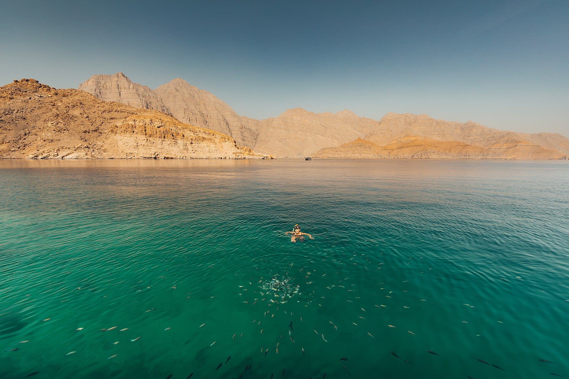
Clear turquoise water in Khor Ash Sham beneath rocky mountains.
Photo Robert Haandrikman · CC BY 2.0
Photo on Wikimedia Commons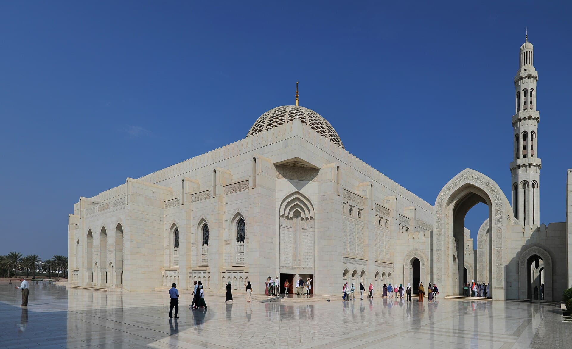
The white stone façade and minaret of the Sultan Qaboos Grand Mosque against a clear blue sky.
Photo Francesco Bini · CC BY-SA 4.0
Photo on Wikimedia Commons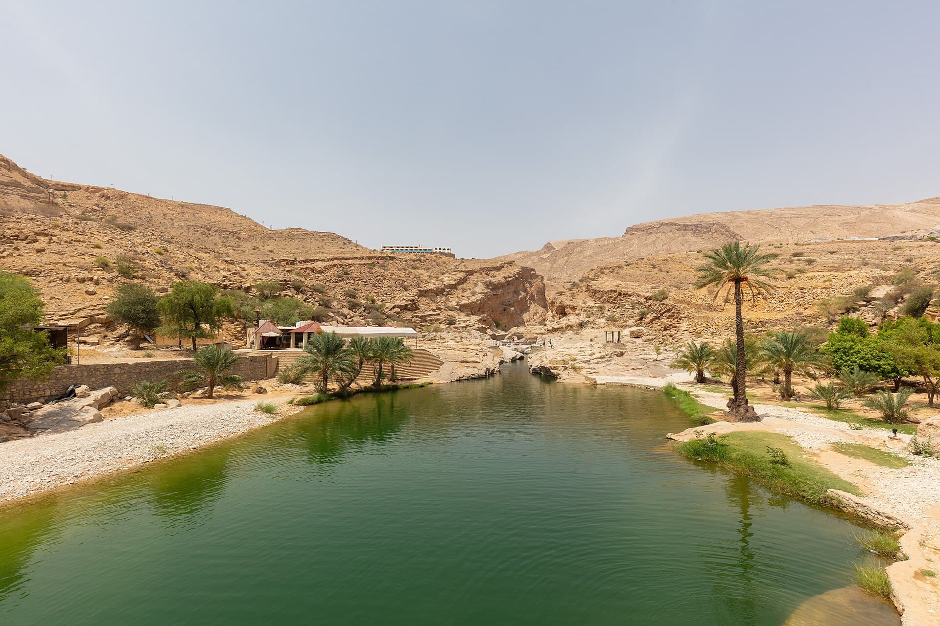
A green pool in Wadi Bani Khalid between pale rocks and palm trees.
Photo Diego Delso · CC BY-SA 4.0
Photo on Wikimedia Commons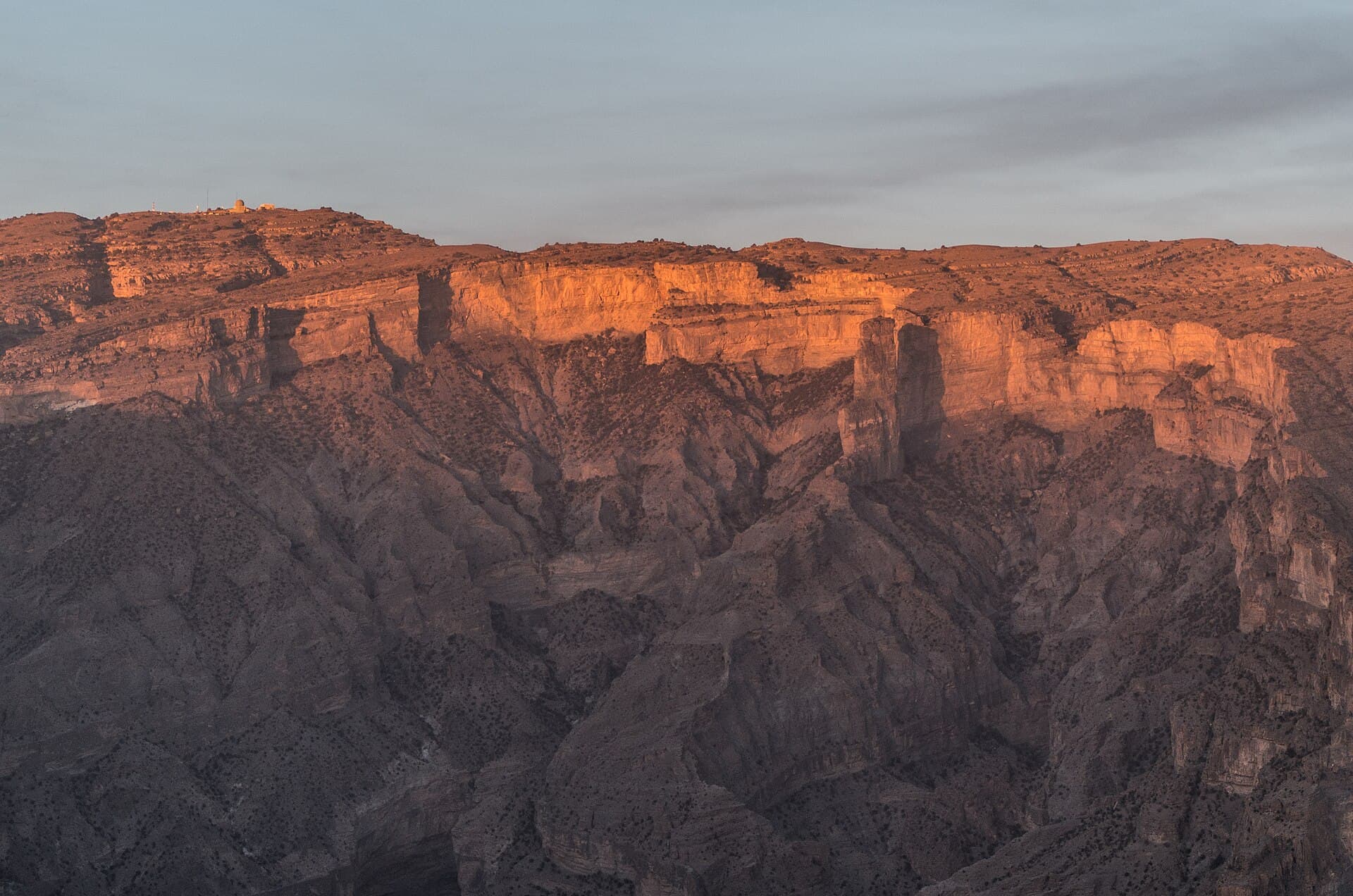
The rock walls of Wadi Nakhur below Jebel Shams at sunset.
Photo Fabien LE JEUNE from France · CC BY 2.0
Photo on Wikimedia Commons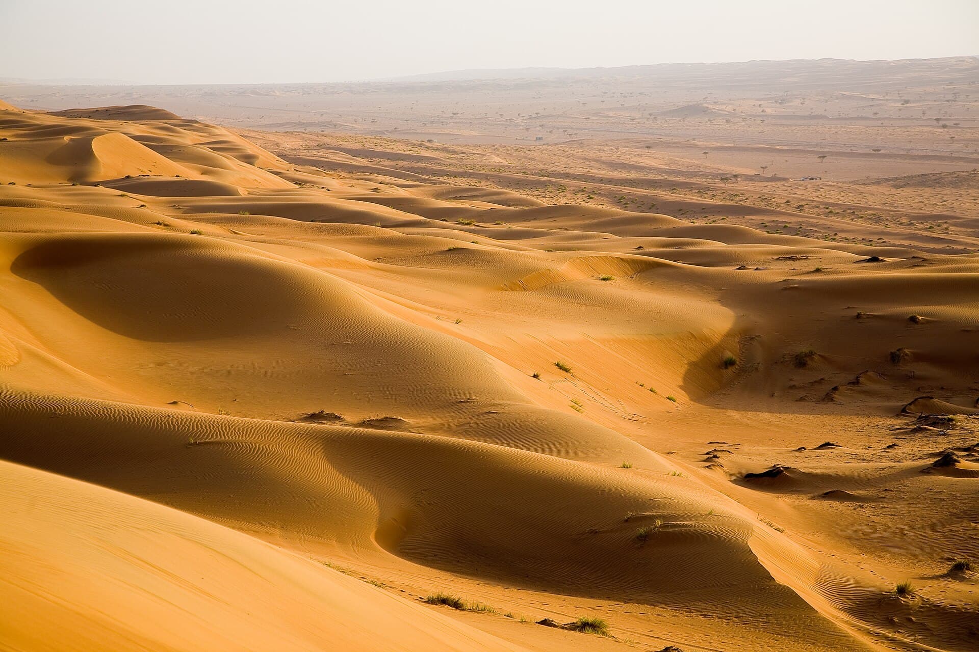
Golden dunes of the Sharqiya Sands rolling towards the horizon.
Photo Andries Oudshoorn · CC BY-SA 2.0
Photo on Wikimedia Commons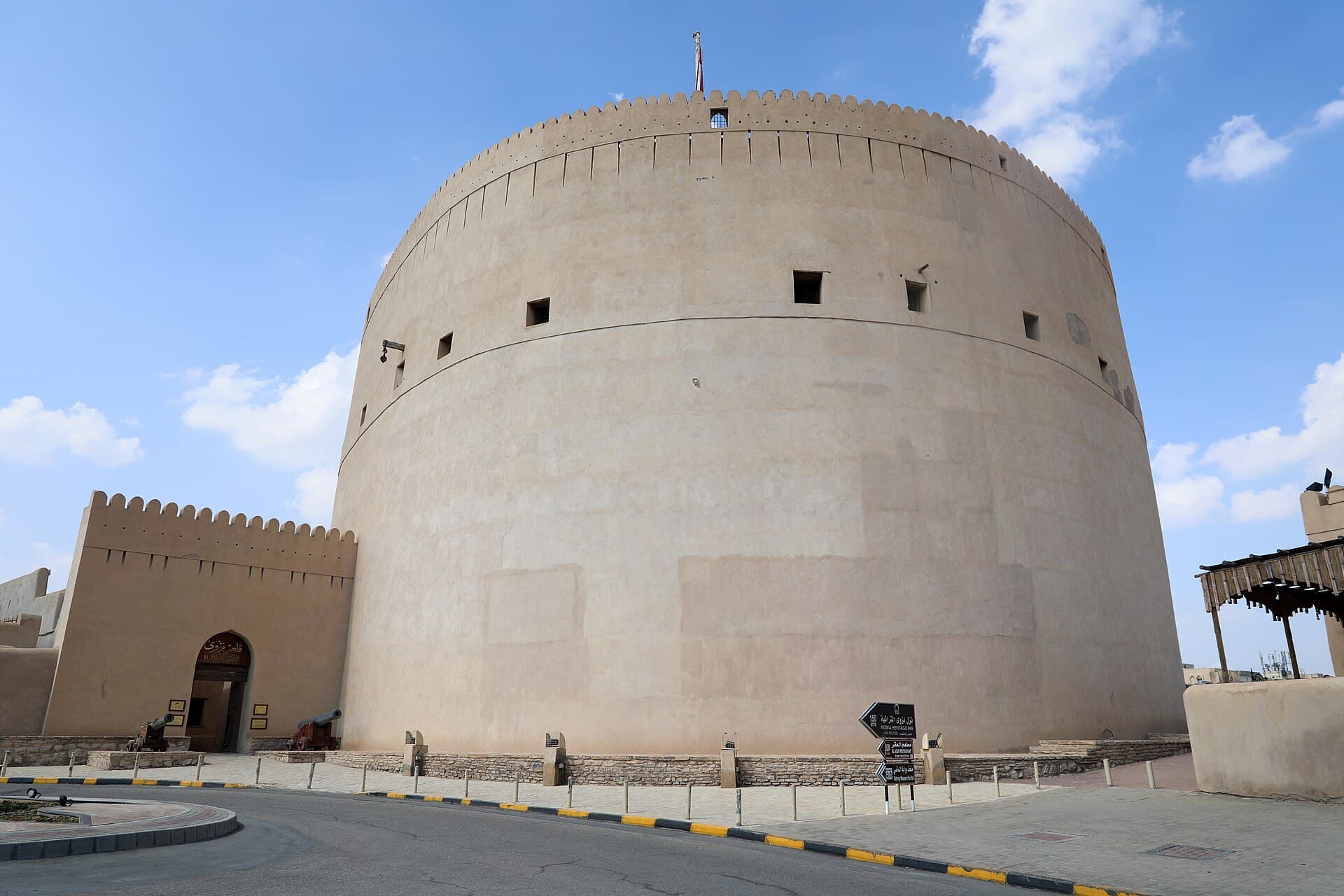
The massive round tower of Nizwa Fort from outside, beside a crenellated wall.
Photo Francesco Bini · CC BY-SA 4.0
Photo on Wikimedia Commons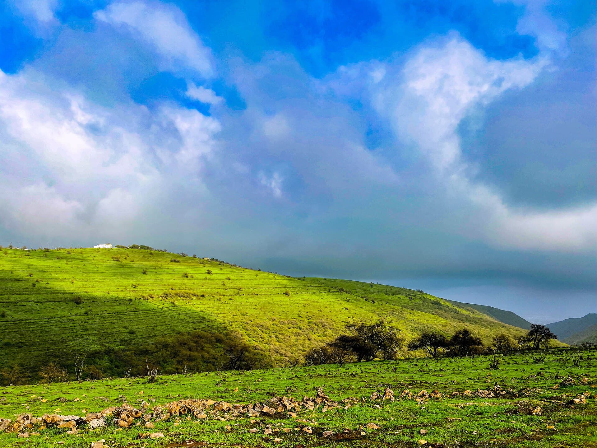
A green meadow under heavy cloud near Salalah in the khareef season.
Photo MURSHID THALI PARAMBAN · CC BY-SA 4.0
Photo on Wikimedia CommonsSoutheastern Arabian Peninsula, on the Gulf of Oman and the Arabian Sea
Oman
Mud-brick forts, green wadis cut into rock, dunes, fjords and the monsoon mist of the south.
Oman sits in the southeastern corner of the Arabian Peninsula, facing the Gulf of Oman to the northeast and the Arabian Sea to the southeast, with Saudi Arabia, the United Arab Emirates and Yemen as land neighbours. At about 315,331 square kilometres it is the third-largest country on the peninsula, home to roughly 5.4 million people. Muscat is both the capital and the largest city, and Arabic is the official language. In the far north, the Musandam governorate is cut off from the rest of the country by Emirati territory and looks out over the Strait of Hormuz.
The Hajar Mountains split the north into a coast and an interior, running from the tip of Musandam all the way to Sur. They hold Jebel Shams, the country's highest peak at 3,009 metres, and the Jebel Akhdar with its plateau and terraced orchards. Valleys and desert cover 82 percent of the land, mountains 15 percent and the coastal plain a mere 3 percent. In this dry country, aflaj — ancient channels that carry water from springs and aquifers — have watered villages and palm groves for centuries.
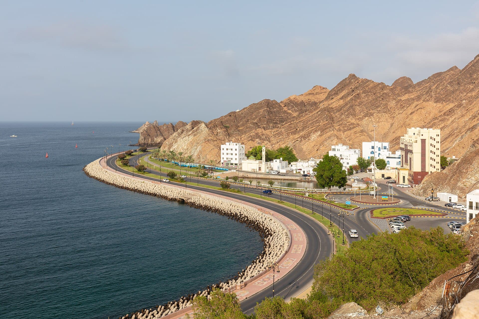
Muscat is a low, white city squeezed between sea and mountains. Its landmarks include the Sultan Qaboos Grand Mosque, completed in 2001 with a 90-metre main minaret, the Royal Opera House, which opened in 2011, and the old Muttrah waterfront with its souq. Some 140 kilometres inland lies Nizwa, with its round-towered fort and busy market, and close by stands Bahla Fort, the first Omani site added to the World Heritage List, in 1987.
On the east coast, Sur has been building wooden ships for generations, and about 60 kilometres away green turtles come ashore to nest at Ras al-Jinz, the easternmost point of the Arabian Peninsula. Inland, the Sharqiya Sands spread over 12,500 square kilometres, with the pools and boulders of Wadi Bani Khalid nearby. Far to the south, the Dhofar mountains around Salalah turn green during the khareef monsoon from June to September, and the region holds the Land of Frankincense World Heritage sites. At the other end of the country, the sea pushes deep between Musandam's mountains in long, fjord-like inlets.
Winter, from December to February, is the time for the north, with temperatures between 18 and 26°C; the hot season runs from March to September. Salalah works the other way round: its season is summer, when the khareef brings mist and drizzle. The currency is the Omani rial, divided into 1,000 baisa, and the clock runs on UTC+4. Oman has five World Heritage sites, all cultural: Bahla Fort, the archaeological sites of Bat, Al-Khutm and Al-Ayn, the Land of Frankincense, the aflaj irrigation systems and the ancient city of Qalhat.
Key cities and regions
Muscat
The capital between sea and mountains: the Grand Mosque, the Royal Opera House and the Muttrah waterfront and souq.
Nizwa
The historic city of the interior, with its round fort and souq, near World Heritage-listed Bahla Fort.
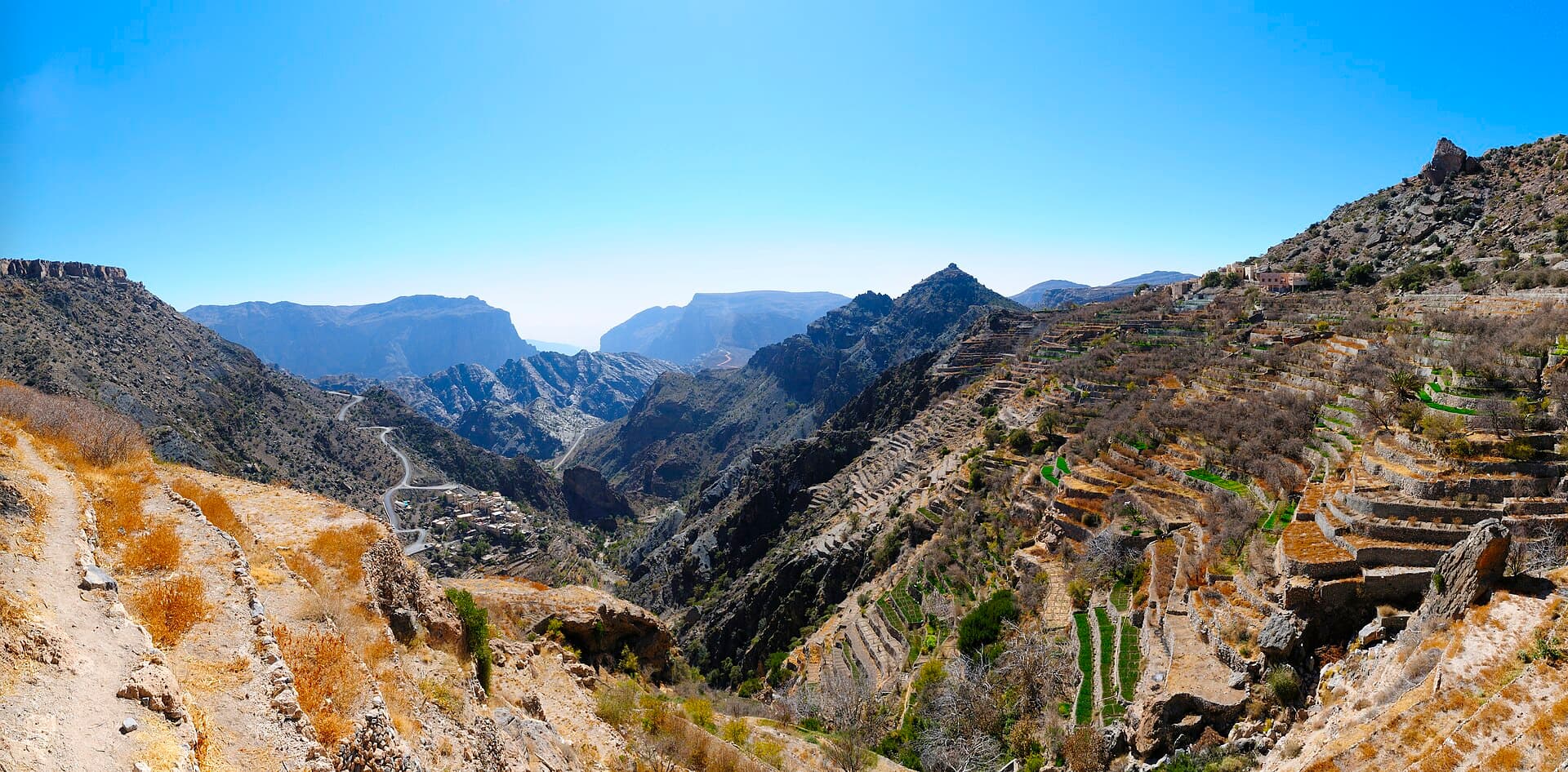
Jebel Akhdar and Jebel Shams
The heart of the Hajar: the Saiq Plateau and its terraces, the country's highest peak and the village of Misfat al Abriyeen.
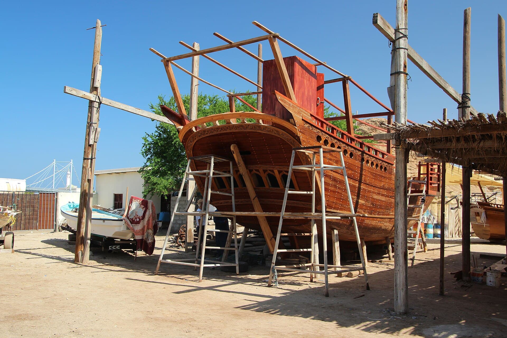
Sur
The shipbuilding town of the east coast, near the turtles of Ras al-Jinz and the ruins of Qalhat.
Sharqiya Sands
A sea of dunes covering 12,500 km², with the pools and boulders of Wadi Bani Khalid on its edge.
Salalah
Dhofar's capital, green in the khareef season, and the frankincense sites of Al-Baleed and Khor Rori.
Musandam
A peninsula on the Strait of Hormuz, with mountain-walled inlets crossed by Khasab's wooden dhows.
Want to know Oman better?
A journey in photos, maps, and figures—one step at a time.
What does a flight to Oman cost—and when is it cheaper?
Check from your city →FAQ about Oman
When is the best time to visit Oman?
Winter, from December to February, is the best time for Muscat, the interior and the desert, with temperatures between 18 and 26°C. The hot season lasts from March to September. Salalah is the exception: its season runs from June to September, when the khareef brings mist, light rain and green mountains.
How many days do you need?
Five days cover Muscat, Nizwa and a night on the Jebel Akhdar or Jebel Shams. A week to ten days adds Sur, Ras al-Jinz, the Sharqiya Sands and Wadi Bani Khalid. Salalah and Musandam are both far from Muscat, so give each at least two or three days.
Is Oman expensive to visit?
The overall price level in 2025 was about 47% of the US level, calculated from the World Bank's purchasing power parity and exchange rate data. That measures the whole economy, not your hotel bill, and real costs vary widely between resorts, desert camps and simple local restaurants.
What currency is used?
The Omani rial, which is divided into 1,000 baisa rather than 100. World Bank data has held it at 0.3845 rial to the US dollar in recent years, so a single rial is worth more than two and a half dollars, and small prices are often quoted in baisa.
What are the best-known Omani dishes?
Shuwa is the festive one: meat marinated in a spiced date paste, wrapped and cooked in a pit in the ground. Everyday favourites include qabuli rice, harees and mashuai, a whole spit-roasted kingfish served with lemon rice. Cardamom coffee comes with dates and Omani halwa as a welcome to guests.
How do you get around Oman?
Most visitors rent a car: Nizwa is about 140 kilometres from Muscat and Sur about 203. The Jebel Akhdar can only be reached by four-wheel drive. Domestic flights link Muscat with Salalah and Khasab, and a fast ferry runs between Muscat and Musandam.
Do I need a visa?
It depends on your nationality, and the rules change. Before booking, check the Royal Oman Police eVisa website, ask the Omani embassy in your country of residence if your case is unclear, and check again a few days before you travel.
Photos (26)
Sources & photo credits(41 sources · 38 photos · last verified 2026-10-04)
- 1.Oman · Wikipedia · Accessed 2026-10-04
- 2.Geography of Oman · Wikipedia · Accessed 2026-10-04
- 3.Oman — World Heritage properties · UNESCO World Heritage Centre · Accessed 2026-10-04
- 4.Muscat · Wikipedia · Accessed 2026-10-04
- 5.Muttrah · Wikipedia · Accessed 2026-10-04
- 6.Sultan Qaboos Grand Mosque · Wikipedia · Accessed 2026-10-04
- 7.Royal Opera House Muscat · Wikipedia · Accessed 2026-10-04
- 8.Al Jalali Fort · Wikipedia · Accessed 2026-10-04
- 9.National Museum (Oman) · Wikipedia · Accessed 2026-10-04
- 10.Nizwa · Wikipedia · Accessed 2026-10-04
- 11.Nizwa Fort · Wikipedia · Accessed 2026-10-04
- 12.Bahla Fort · Wikipedia · Accessed 2026-10-04
- 13.Jebel Akhdar (Oman) · Wikipedia · Accessed 2026-10-04
- 14.Jebel Shams · Wikipedia · Accessed 2026-10-04
- 15.Misfat al Abriyeen · Wikipedia · Accessed 2026-10-04
- 16.Aflaj Irrigation Systems of Oman · Wikipedia · Accessed 2026-10-04
- 17.Sur, Oman · Wikipedia · Accessed 2026-10-04
- 18.Ras al-Jinz · Wikipedia · Accessed 2026-10-04
- 19.Ras al Hadd · Wikipedia · Accessed 2026-10-04
- 20.Qalhat · Wikipedia · Accessed 2026-10-04
- 21.Wadi Tiwi · Wikipedia · Accessed 2026-10-04
- 22.Tiwi, Oman · Wikipedia · Accessed 2026-10-04
- 23.Bimmah Sinkhole · Wikipedia · Accessed 2026-10-04
- 24.Sharqiya Sands · Wikipedia · Accessed 2026-10-04
- 25.Wadi Bani Khalid · Wikipedia · Accessed 2026-10-04
- 26.Salalah · Wikipedia · Accessed 2026-10-04
- 27.Khareef · Wikipedia · Accessed 2026-10-04
- 28.Al-Baleed Archaeological Park · Wikipedia · Accessed 2026-10-04
- 29.Frankincense · Wikipedia · Accessed 2026-10-04
- 30.Land of Frankincense · Wikipedia · Accessed 2026-10-04
- 31.Khor Rori · Wikipedia · Accessed 2026-10-04
- 32.Musandam Governorate · Wikipedia · Accessed 2026-10-04
- 33.Khasab · Wikipedia · Accessed 2026-10-04
- 34.Archaeological Sites of Bat, Al-Khutm and Al-Ayn · Wikipedia · Accessed 2026-10-04
- 35.Omani cuisine · Wikipedia · Accessed 2026-10-04
- 36.Omani rial · Wikipedia · Accessed 2026-10-04
- 37.Muscat International Airport · Wikipedia · Accessed 2026-10-04
- 38.PPP conversion factor, GDP (LCU per international $) — Oman · World Bank · Accessed 2026-10-04
- 39.Official exchange rate (LCU per US$, period average) — Oman · World Bank · Accessed 2026-10-04
- 40.Royal Oman Police eVisa (official) · Royal Oman Police · Accessed 2026-10-04
- 41.Experience Oman - Beauty Has An Address · Experience Oman — Ministry of Heritage and Tourism (YouTube) · Accessed 2026-10-04
- The white stone façade and minaret of the Sultan Qaboos Grand Mosque against a clear blue sky. · Francesco Bini · CC BY-SA 4.0
- White arcades around the courtyard of the Sultan Qaboos Grand Mosque, with a dome behind them. · Francesco Bini · CC BY-SA 4.0
- The Muttrah Corniche road curving along the sea between white houses and rocky mountains. · Diego Delso · CC BY-SA 4.0
- Muttrah harbour and its boat moorings, with Muttrah Fort on the hill above the houses. · Eduard Marmet · CC BY-SA 2.0
- The white arched façade of the Royal Opera House Muscat. · Taha Al-Hayali · CC BY-SA 4.0
- A shop in Muttrah Souq crammed with colourful fabrics, lanterns and wooden crafts. · Georg Karl Ell · CC BY-SA 4.0
- Al Jalali Fort and its two towers on a rock above the old harbour of Muscat. · Christoph Strässler · CC BY-SA 2.0
- The massive round tower of Nizwa Fort from outside, beside a crenellated wall. · Francesco Bini · CC BY-SA 4.0
- The courtyards and towers of Nizwa Fort seen from above, with palm groves behind. · Dr. Thomas Liptak · CC BY-SA 4.0
- The mud-brick towers and walls of Bahla Fort rising above the town. · Francisco Anzola · CC BY 2.0
- A round mud tower at Bahla Fort with the Hajar Mountains on the horizon. · Albinfo · CC BY 4.0
- Clay jars in many colours lined up under the arches of Nizwa Souq. · Taha Al-Hayali · CC BY-SA 4.0
- A deep drop on Jebel Shams, its rock layers stepping down to the valley floor. · albinfo · CC BY-SA 4.0
- The rock walls of Wadi Nakhur below Jebel Shams at sunset. · Fabien LE JEUNE from France · CC BY 2.0
- Farm terraces on the edge of a valley on the Jebel Akhdar, with peaks beyond. · Philipp Weigell · CC BY 3.0
- The stone houses of Misfat al Abriyeen among palm trees on the mountainside. · Broc · CC0
- A narrow falaj channel carrying water between palm trees in Misfat al Abriyeen. · dconvertini · CC BY-SA 4.0
- A traditional wooden ship under construction on scaffolding in a Sur boatyard. · Dr. Thomas Liptak · CC BY-SA 4.0
- The frame of a small wooden boat taking shape in a workshop in Sur. · Ji-Elle · CC BY-SA 3.0
- A green pool between the high rock walls of Wadi Shab, with palms on the bank. · Uhooep · CC BY-SA 4.0
- A green turtle on the sand at Ras al-Jinz at night. · Andries Oudshoorn · CC BY-SA 2.0
- The beach and rocky headland of Ras al-Jinz at sunset. · John Crane from Prague, Czech Republic · CC BY 2.0
- Golden dunes of the Sharqiya Sands rolling towards the horizon. · Andries Oudshoorn · CC BY-SA 2.0
- Tall dunes and their shadows in the Sharqiya Sands, with a small car among them. · Andries Oudshoorn · CC BY-SA 2.0
- A green pool in Wadi Bani Khalid between pale rocks and palm trees. · Diego Delso · CC BY-SA 4.0
- A green stream winding between smooth white boulders in Wadi Bani Khalid. · Diego Delso · CC BY-SA 4.0
- Green hills and trees in Dhofar during the khareef season. · Poojaryroshan · CC BY-SA 4.0
- A green meadow under heavy cloud near Salalah in the khareef season. · MURSHID THALI PARAMBAN · CC BY-SA 4.0
- The ruins of the ancient city of Al-Baleed at the water's edge in Salalah. · https://www.flickr.com/photos/pukomuko/ · CC BY 2.0
- The calm water of Khor Rori between sand and hills on the Dhofar coast. · Juozas Šalna · CC BY 2.0
- A short, many-branched frankincense tree in Wadi Dawkah. · Mauro Raffaelli · CC BY-SA 3.0
- A long inlet between the bare mountains of Musandam, seen from above. · PLBechly · CC BY-SA 4.0
- Clear turquoise water in Khor Ash Sham beneath rocky mountains. · Robert Haandrikman · CC BY 2.0
- Wooden dhows in Khor Ash Sham between the mountains of Musandam. · Robert Haandrikman · CC BY 2.0
- A dolphin leaping beside a boat in the waters of Musandam. · Robert Haandrikman · CC BY 2.0
- Domed stone tombs on a ridge at the Al-Ayn archaeological site, with a towering mountain behind. · Arian Zwegers · CC BY 2.0
- A large tray of rice topped with grilled meat on an Omani table. · Erkan Pinar · CC BY 2.0
- Golden Omani halwa with nuts in a large pot. · Meshal humaid Ali Almoqbali · CC BY-SA 4.0