
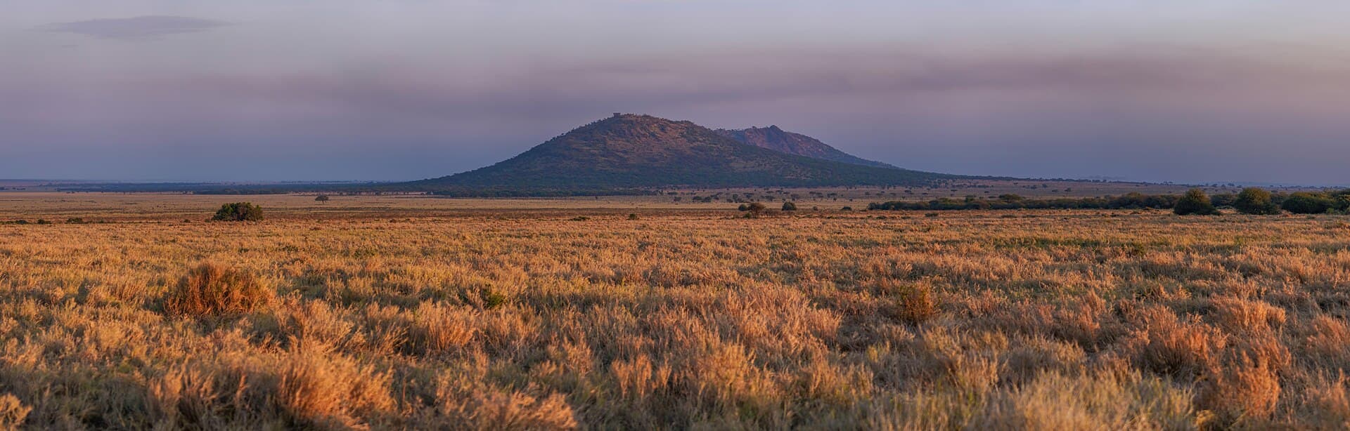
Sunrise over Serengeti National Park, warm light on the savannah horizon.
Photo Giles Laurent · CC BY-SA 4.0
Photo on Wikimedia Commons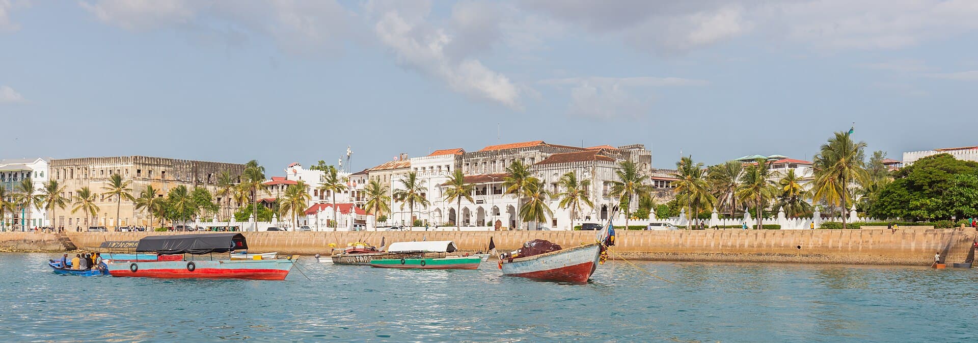
Stone Town harbour front in Zanzibar, pale buildings along the water.
Photo Diego Delso · CC BY-SA 4.0
Photo on Wikimedia Commons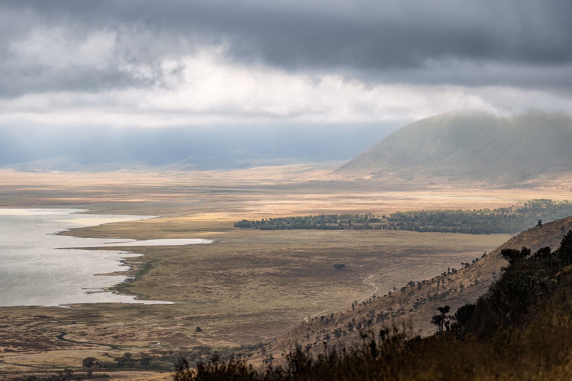
View from the Ngorongoro Crater rim down to the green crater floor.
Photo Eric Kilby · CC BY-SA 2.0
Photo on Wikimedia Commons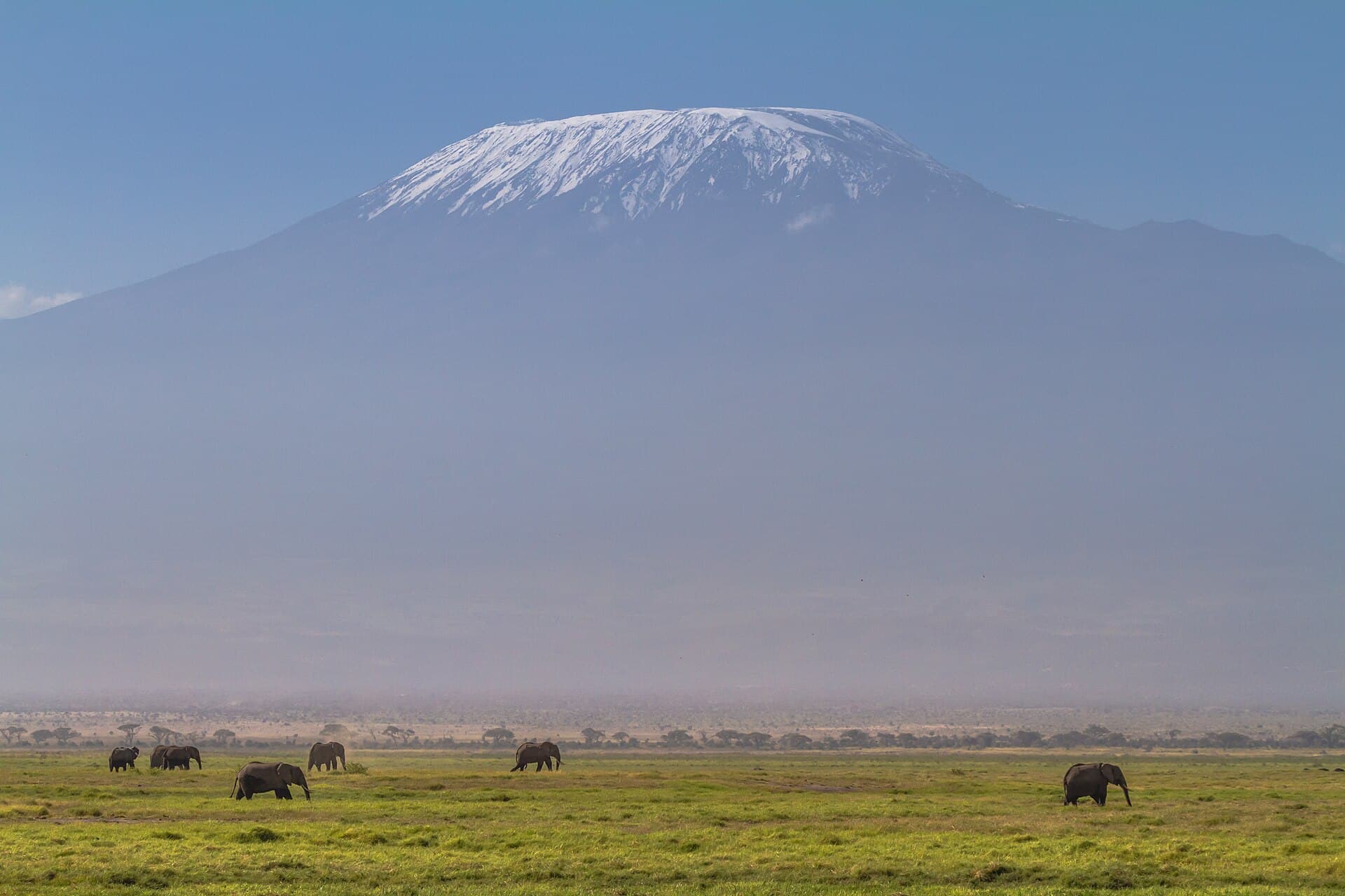
Kilimanjaro from the Amboseli plains: a snowy cone on the horizon.
Photo Benh LIEU SONG · CC BY-SA 4.0
Photo on Wikimedia Commons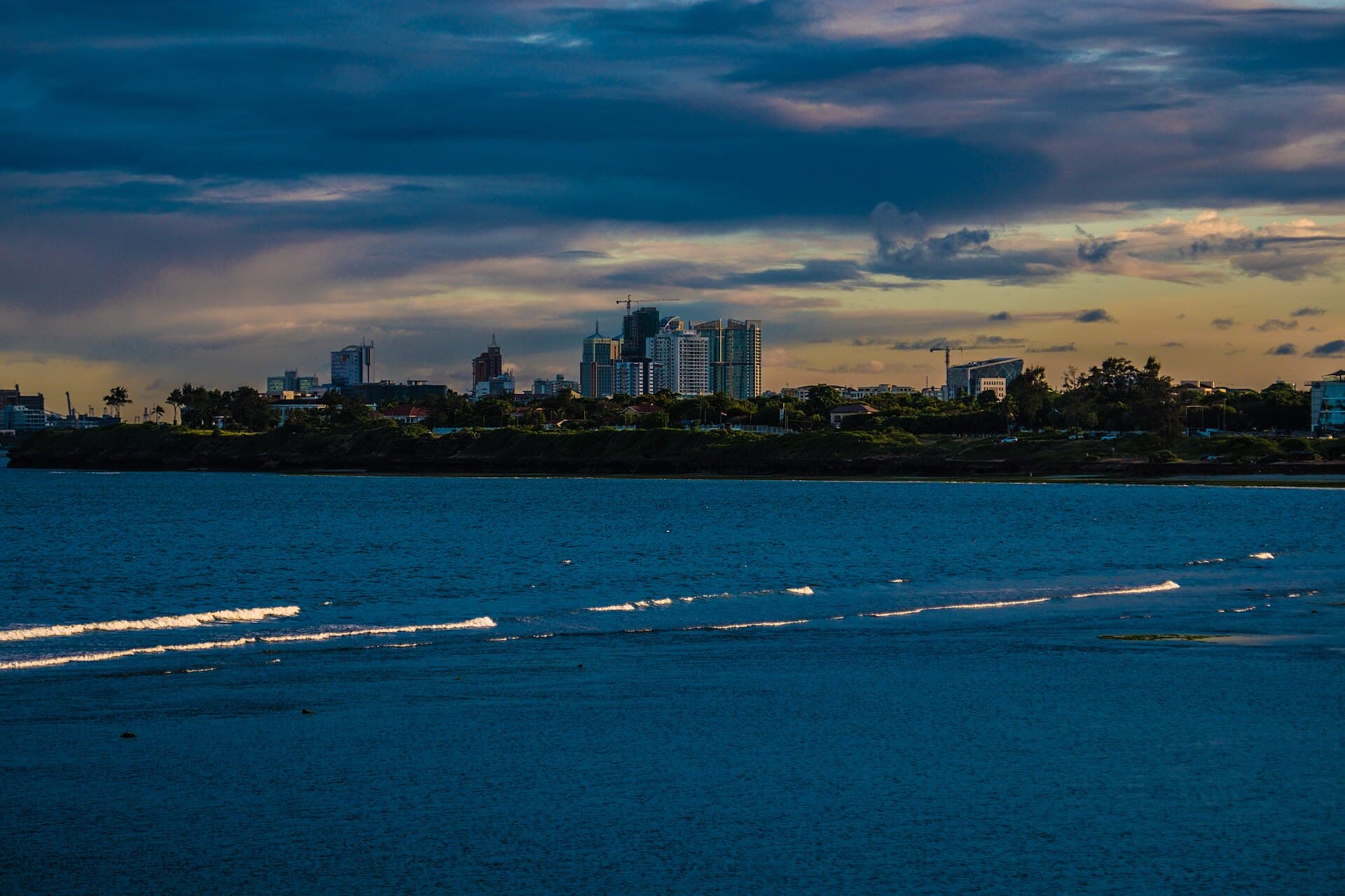
Dar es Salaam city skyline with high-rises under a clear sky.
Photo Isingo Raphael · CC BY-SA 4.0
Photo on Wikimedia Commons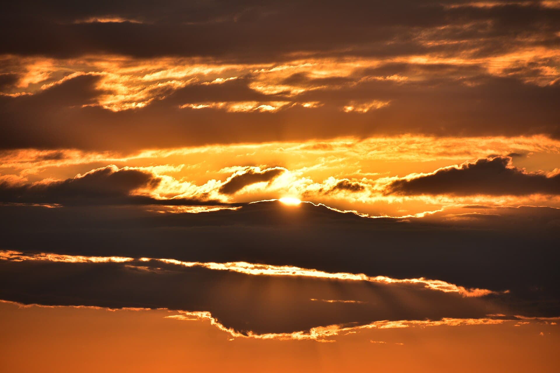
Sunset on the Rufiji River in the former Selous reserve.
Photo Richard Mortel from Riyadh, Saudi Arabia · CC BY 2.0
Photo on Wikimedia Commons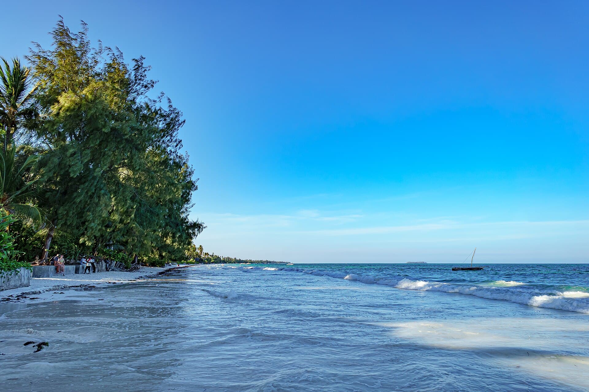
Nungwi beach in northern Unguja, pale sand and turquoise water.
Photo Nina R from Africa · CC BY 2.0
Photo on Wikimedia Commons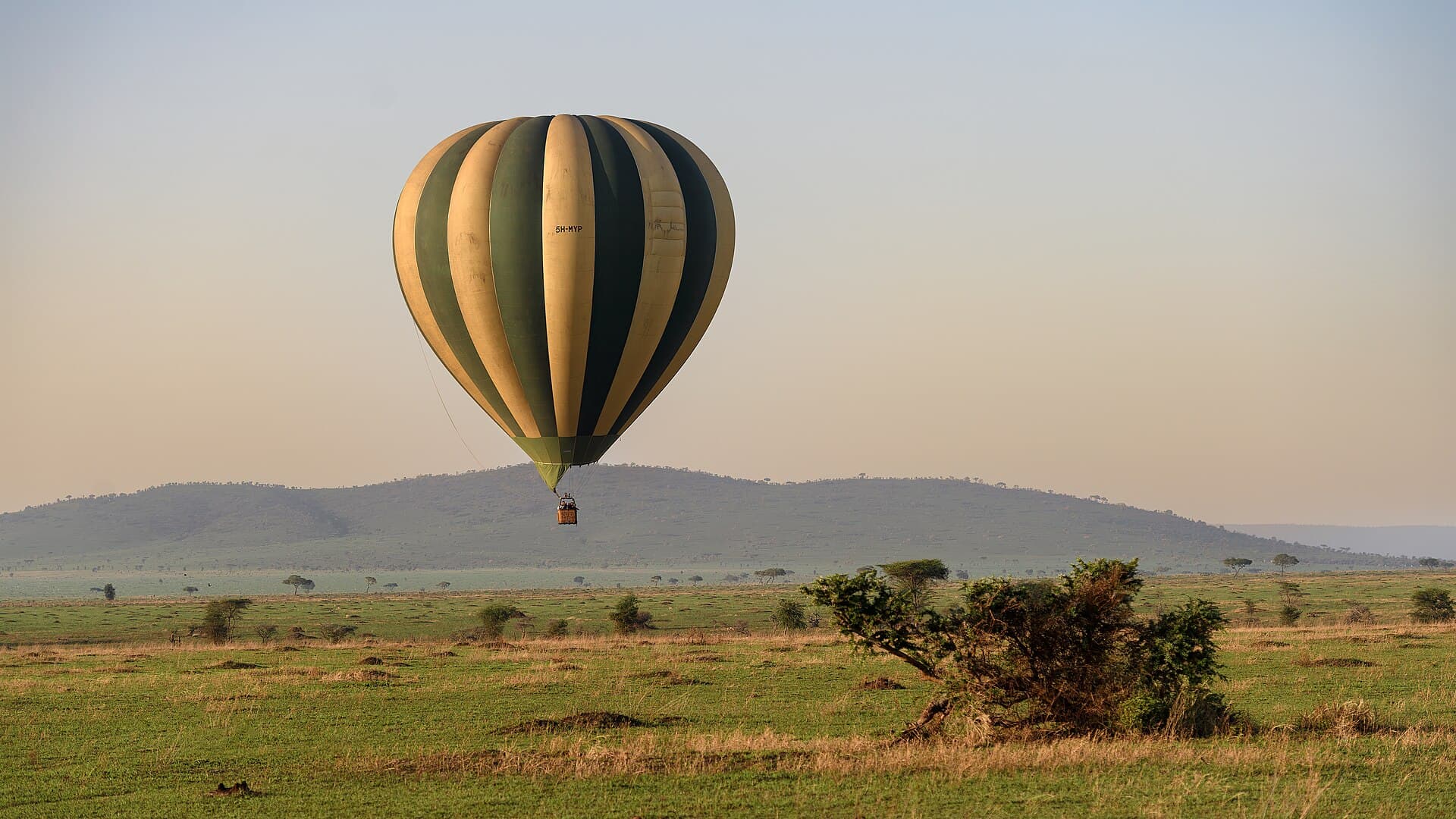
Hot-air balloon over the Serengeti plains at sunrise.
Photo Eric Kilby · CC BY-SA 2.0
Photo on Wikimedia CommonsEast Africa · Great Lakes & the Indian Ocean
Tanzania
Serengeti savannah, Ngorongoro’s crater, Kilimanjaro’s summit, and Zanzibar’s islands—inside one country.
Tanzania sits in East Africa’s Great Lakes region, with the Indian Ocean to the east and Kenya and Uganda to the north, stretching west toward the great lakes and south toward Mozambique, Malawi and Zambia. Dodoma is the official capital, while Dar es Salaam is the largest city and the coastal gateway most travellers meet first. Land area is about 947,303 km². A 2024 population estimate is about 67.5 million; the 2022 census figure is 61,741,120.
The journey is not one landscape. In the north, Serengeti National Park has covered about 14,763 km² since its 1940 founding, Ngorongoro Conservation Area spans about 8,292 km² around a vast caldera, and Uhuru Peak on Kilimanjaro is commonly cited at 5,895 m inside a national park inscribed by UNESCO in 1987. On the coast and islands: Dar es Salaam is a harbour city; Zanzibar (Unguja) holds Stone Town, a World Heritage site since 2000; Pemba is the archipelago’s northern island—still Tanzania, not a separate country.
Zanzibar belongs inside this destination: Stone Town’s waterfront, the Old Fort, the House of Wonders and beaches such as Nungwi and Paje live in the places chapter. Pemba adds about 988 km² and 543,441 residents (2022 census), with mangrove views from Chake Chake and harbours such as Wete. In the south, Nyerere National Park was created in 2019 from the northern part of the former Selous Game Reserve, at 30,893 km², while historic Selous remains among Tanzania’s UNESCO properties.
The climate is mainly tropical with altitude shifts. Geography of Tanzania describes the hottest stretch roughly from November to February and a cooler one from May to August. North and east see short rains (Vuli) around October–December and long rains (Masika) around March–May, so the clearer window between them is roughly June–October. South, west and central areas run a longer wet season from about October into April or May. The coastline is about 1,424 km in the geography infobox.
Swahili is the national language; Swahili and English are de facto official. The currency is the Tanzanian shilling; the zone is UTC+3. The 2024 economy-wide price level is about 28% of the US level from World Bank PPP and exchange-rate series—not a safari quote. Gateways are DAR, JRO and ZNZ. UNESCO lists seven inscribed properties. The explore journey goes deeper, place by place.
Key cities and regions
Dar es Salaam
Largest city and coastal gateway: harbour, urban skyline and international airport—not the official capital.
Zanzibar (Unguja)
Main archipelago island: World Heritage Stone Town, plus north and east-coast beaches.
Serengeti National Park
Savannah park of about 14,763 km², UNESCO-listed, among East Africa’s great plains.
Ngorongoro Conservation Area
Conservation area around a vast volcanic crater; World Heritage since 1979.
Mount Kilimanjaro
Africa’s highest summit at about 5,895 m; the national park has been World Heritage since 1987.
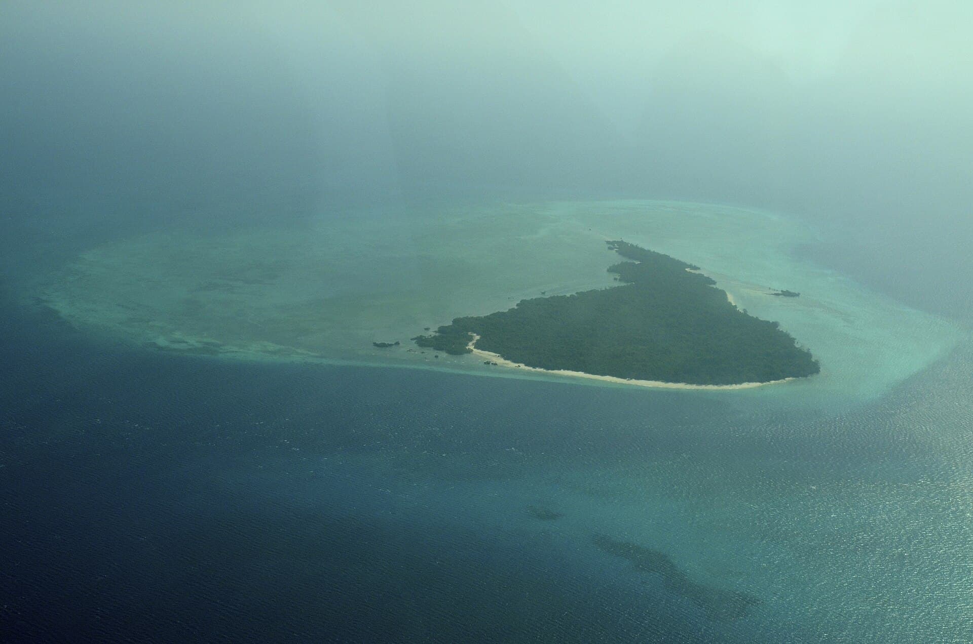
Pemba Island
Northern island of the Zanzibar Archipelago: mangroves, harbours and quieter shores than Unguja.
Nyerere National Park
The country’s largest national park (30,893 km²), created in 2019 from northern Selous.
Want to know Tanzania better?
A journey in photos, maps, and figures—one step at a time.
What does a flight to Tanzania cost—and when is it cheaper?
Check from your city →FAQ about Tanzania
When is the best time to visit Tanzania?
Geography of Tanzania describes short rains in the north and east roughly from October to December and long rains from March to May. The clearer window between them runs about June to October for northern plains and coastal planning. South, west and central regions have a longer wet season from about October into April or May. The hottest stretch is November–February; the relatively cooler one is May–August in the geography description.
How many days do you need?
Eight to ten days cover a classic northern circuit: arrival via Kilimanjaro or Dar es Salaam, then Serengeti and Ngorongoro, with an optional lowland Kilimanjaro viewing day. Add three to five days for Zanzibar if you want Stone Town and beach time. Fifteen days open Pemba or southern Nyerere without rushing road and light-aircraft transfers.
Is Tanzania expensive for travellers?
The 2024 economy-wide price level is about 28% of the US level from World Bank PPP and exchange-rate indicators—measuring the whole economy, not park fees or resorts. Northern safari camps and Zanzibar beach stays usually cost more than urban nights in Dar es Salaam. Daily costs vary widely with the circuit and the type of camp or lodge.
What currency is used, and are cards accepted?
The official currency is the Tanzanian shilling. Tourism mixes cash and cards: larger hotels and organised camps are clearer on card acceptance, while small markets may prefer cash. Carry some shillings or dollars for places cards fail, and confirm payment method when you book.
How do you move between mainland and islands?
Dar es Salaam airport serves the coast and south, Kilimanjaro airport serves the northern circuit, and Zanzibar airport serves Unguja. Mainland–Zanzibar links are short flights or ferries by schedule. Inside Serengeti and Ngorongoro you travel in organised safari vehicles. Distances are large; do not plan them like a connected city grid.
Is Zanzibar a separate country from Tanzania?
No. Zanzibar is an archipelago within the United Republic of Tanzania: Unguja (what many travellers mean by “Zanzibar”) and Pemba among others. Stone Town on Unguja has been a World Heritage site since 2000. That is why you find them here among Tanzania’s places.
Do I need a visa?
Rules depend on nationality and length of stay, and they change. Check the official Tanzania Immigration Services site before you book, and ask the mission for your country of residence if your case is unclear.
Photos (27)
Sources & photo credits(30 sources · 49 photos · last verified 2026-09-27)
- 1.Tanzania · Wikipedia · Accessed 2026-09-27
- 2.Geography of Tanzania · Wikipedia · Accessed 2026-09-27
- 3.Dar es Salaam · Wikipedia · Accessed 2026-09-27
- 4.Zanzibar · Wikipedia · Accessed 2026-09-27
- 5.Stone Town · Wikipedia · Accessed 2026-09-27
- 6.Serengeti National Park · Wikipedia · Accessed 2026-09-27
- 7.Ngorongoro Conservation Area · Wikipedia · Accessed 2026-09-27
- 8.Mount Kilimanjaro · Wikipedia · Accessed 2026-09-27
- 9.Kilimanjaro National Park · Wikipedia · Accessed 2026-09-27
- 10.Pemba Island · Wikipedia · Accessed 2026-09-27
- 11.Nyerere National Park · Wikipedia · Accessed 2026-09-27
- 12.Selous Game Reserve · Wikipedia · Accessed 2026-09-27
- 13.House of Wonders · Wikipedia · Accessed 2026-09-27
- 14.Old Fort of Zanzibar · Wikipedia · Accessed 2026-09-27
- 15.Forodhani Gardens · Wikipedia · Accessed 2026-09-27
- 16.Tourism in Tanzania · Wikipedia · Accessed 2026-09-27
- 17.Julius Nyerere International Airport · Wikipedia · Accessed 2026-09-27
- 18.Kilimanjaro International Airport · Wikipedia · Accessed 2026-09-27
- 19.Abeid Amani Karume International Airport · Wikipedia · Accessed 2026-09-27
- 20.United Republic of Tanzania — World Heritage properties · UNESCO World Heritage Centre · Accessed 2026-09-27
- 21.Stone Town of Zanzibar · UNESCO World Heritage Centre · Accessed 2026-09-27
- 22.Ngorongoro Conservation Area · UNESCO World Heritage Centre · Accessed 2026-09-27
- 23.Serengeti National Park · UNESCO World Heritage Centre · Accessed 2026-09-27
- 24.Kilimanjaro National Park · UNESCO World Heritage Centre · Accessed 2026-09-27
- 25.Selous Game Reserve · UNESCO World Heritage Centre · Accessed 2026-09-27
- 26.Tanzania Tourist Board · Tanzania Tourist Board · Accessed 2026-09-27
- 27.Unforgettable By Nature — Campaign · Tanzania Unforgettable (Tanzania Tourist Board campaign) · Accessed 2026-09-27
- 28.Immigration Services Department of Tanzania · United Republic of Tanzania · Accessed 2026-09-27
- 29.PPP conversion factor, GDP — Tanzania · World Bank · Accessed 2026-09-27
- 30.Official exchange rate — Tanzania · World Bank · Accessed 2026-09-27
- Serengeti plains under low cloud, open grassland without buildings. · Eric Kilby · CC BY-SA 2.0
- A green oasis in dry Serengeti savannah, trees around a damp hollow. · Eric Kilby · CC BY-SA 2.0
- Sunrise over Serengeti National Park, warm light on the savannah horizon. · Giles Laurent · CC BY-SA 4.0
- Another Serengeti sunrise, clear sky above short grass. · Giles Laurent · CC BY-SA 4.0
- 2012 Serengeti savannah view with scattered acacia trees on the plain. · Bjørn Christian Tørrissen · CC BY-SA 3.0
- Low panorama of the Serengeti plain, grass stretching to the horizon. · Diego Delso · CC BY-SA 4.0
- View from the Ngorongoro Crater rim down to the green crater floor. · Eric Kilby · CC BY-SA 2.0
- Ngorongoro Crater from above: a volcanic ring and a wide floor. · "Daniel Fafard (Dreamdan)" · CC BY-SA 3.0
- Grassy hills inside the Ngorongoro Conservation Area. · Diego Delso · CC BY-SA 4.0
- Panorama of the Ngorongoro volcanic crater under a clear sky. · Diego Delso · CC BY-SA 4.0
- Sunset light on hills in the Ngorongoro Conservation Area. · Diego Delso · CC BY-SA 4.0
- Mount Kilimanjaro from the air: snow-capped Kibo above the clouds. · Charles J Sharp · CC BY 2.5
- Kilimanjaro from the Amboseli plains: a snowy cone on the horizon. · Benh LIEU SONG · CC BY-SA 4.0
- Amboseli National Park with Mount Kilimanjaro snow-capped beyond. · Ninaras · CC BY 4.0
- Shallow Lake Amboseli with snow-capped Kilimanjaro on the skyline. · Ray in Manila · CC BY 2.0
- Stone Town harbour front in Zanzibar, pale buildings along the water. · Diego Delso · CC BY-SA 4.0
- Wider view of Stone Town’s port, boats and coastal buildings. · Diego Delso · CC BY-SA 4.0
- The Old Fort in Stone Town, massive stone walls on the waterfront. · Diego Delso · CC BY-SA 4.0
- Forodhani Gardens on Stone Town’s seafront. · Diego Delso · CC BY-SA 4.0
- House of Wonders in Stone Town, multi-storey arcaded façade. · Moongateclimber · CC BY-SA 4.0
- The Sultan’s Palace on Stone Town’s waterfront, a long coastal building. · Diego Delso · CC BY-SA 4.0
- Nungwi beach in northern Unguja, pale sand and turquoise water. · Nina R from Africa · CC BY 2.0
- Paje beach at low tide, wide sand flats and shallow water. · Matt Kieffer from London, United Kingdom · CC BY-SA 2.0
- Jambiani beach on Unguja’s east coast. · Jonathan Dalrymple · CC BY-SA 4.0
- House of Wonders from the coastal side, columns and arcades near the water. · Matthias Zirngibl from Germany · CC BY 2.0
- Dar es Salaam city skyline with high-rises under a clear sky. · Isingo Raphael · CC BY-SA 4.0
- Dar es Salaam harbour: wharves and ships in the port. · Cassim abdallah · CC BY-SA 4.0
- An urban street in Dar es Salaam with mixed-height buildings. · Wvuijk · CC BY-SA 4.0
- Evening waves on the Dar es Salaam shore, open sea horizon. · Eusebius Ngemera · CC BY-SA 4.0
- The Posta area of Dar es Salaam, busy urban façades. · Dicksonpicha · CC BY-SA 4.0
- Misali Island shore near Pemba, clear water and a low coastline. · Jojona · CC BY-SA 3.0
- Bush and river cover in the Selous / Nyerere landscape. · Shilpa Suraj · CC BY-SA 4.0
- Sunset on the Rufiji River in the former Selous reserve. · Richard Mortel from Riyadh, Saudi Arabia · CC BY 2.0
- Rufiji River banks inside the reserve, water and dense trees. · Richard Mortel from Riyadh, Saudi Arabia · CC BY 2.0
- Another Rufiji bend in Selous, river curve through greenery. · Richard Mortel from Riyadh, Saudi Arabia · CC BY 2.0
- Open savannah in Selous, grassland under a wide sky. · Laika ac from USA · CC BY-SA 2.0
- Hot-air balloon over the Serengeti plains at sunrise. · Eric Kilby · CC BY-SA 2.0
- Safari balloon glowing before lift-off above the savannah. · Harvey Barrison from Massapequa, NY, USA · CC BY-SA 2.0
- A Zanzibar spice farm with tropical plants in rows. · Laika ac from USA · CC BY-SA 2.0
- Dried Zanzibar spices displayed in many colours. · Bärbel Miemietz · CC BY-SA 4.0
- A traditional sailing dhow on Zanzibar waters. · Sarvesh Lutchmun · CC BY-SA 4.0
- Panorama of Tarangire National Park plains with baobab trees. · Diego Delso · CC BY-SA 4.0
- View from Chake Chake across Pemba mangroves toward the sea. · Vincent van Zeijst · CC BY-SA 3.0
- Ngezi Forest on Pemba, dense green canopy. · Marcel Oosterwijk from Amsterdam, The Netherlands · CC BY-SA 2.0
- Wete harbour on Pemba, boats on calm water. · Marcel Oosterwijk from Amsterdam, The Netherlands · CC BY-SA 2.0
- Satellite view of Pemba Island in the Indian Ocean. · Coordenação-Geral de Observação da Terra/INPE · CC BY-SA 2.0
- View from Chake Chake on Pemba toward coastal hills. · Vincent van Zeijst · CC BY-SA 3.0
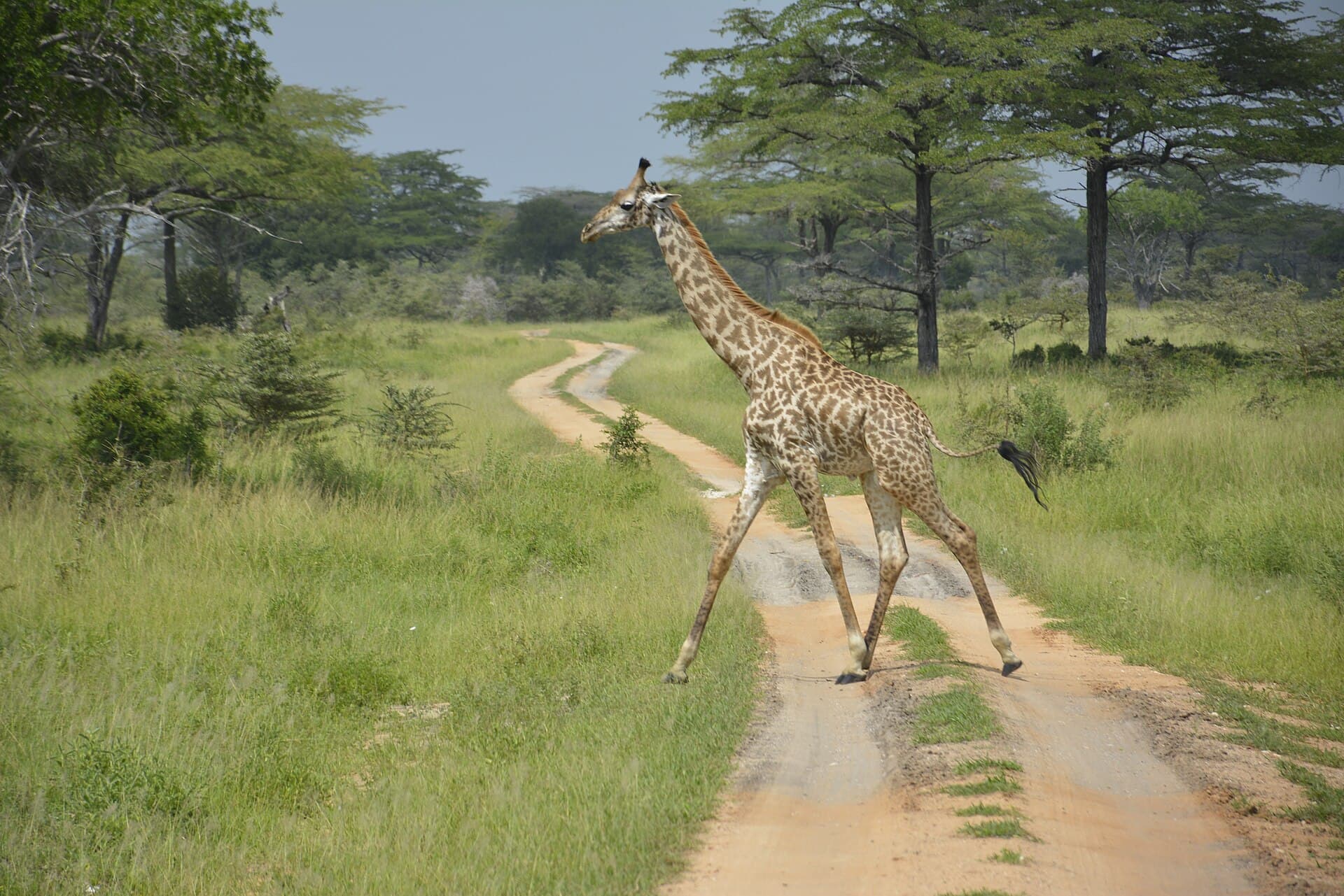
- A Masai giraffe among savannah trees in Serengeti National Park. · Giles Laurent · CC BY-SA 4.0
- Wide panoramic view across the Ngorongoro highlands. · Diego Delso · CC BY-SA 4.0